Arizona’s Rillito River Park Trail
Trail of the Month: February 2025
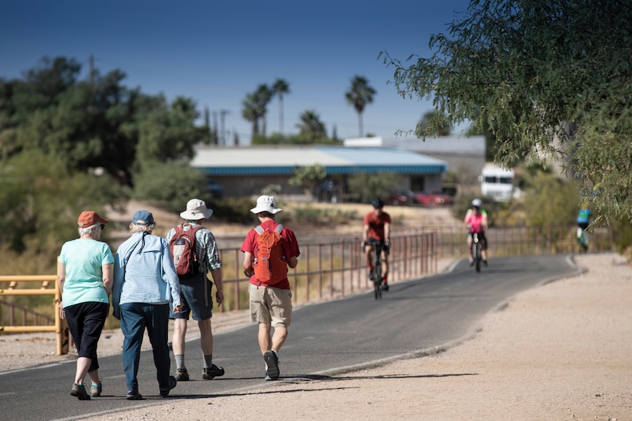
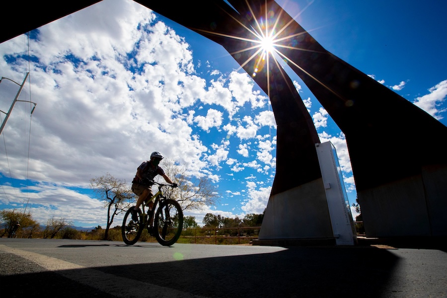
As a supporting player in the larger Chuck Huckelberry Loop (which took top trail honors in USA Today’s Readers’ Choice polls in both 2021 and 2022), Tucson’s Rillito River Park Trail more than holds its own in the 137-mile trail network. Following the banks of Tucson’s seasonal Rillito River, the 22.4-mile trail cuts a mostly northwest-to-southeast swath across the southern Arizona city, providing access to bustling shopping areas, employment centers and popular attractions.
“[The Loop] connects us to nature, it connects us to resources, it connects us to education, entertainment, everything.”
— Logan Havens, local resident
“The Loop is probably one of the best aspects of the city,” said photographer Logan Havens, who, like most locals, refers to the Chuck Huckelberry Loop (named after a longtime Pima County administrator and avid cyclist) as simply The Loop. “It connects us to nature, it connects us to resources, it connects us to education, entertainment, everything.”
Havens, who does not have a car, lives along The Loop’s Santa Cruz section and gets around the city mostly by biking and walking. Nearly every Sunday, he bikes the Rillito River section to the Heirloom Farmers Markets, where he shops for products like roasted chile peppers, locally grown figs and citrus, and fresh pasta.
Adjacent to the farmers markets, the trailside Rillito Race Track, which has been closed to horse racing for several years because of needed repairs, is expected to be another draw once refurbished. While the trail is paved, a parallel soft-surface path is available for equestrians along most of the route.
“Horse racing has been a cherished tradition in Tucson for generations,” said Callie Norton, the community engagement coordinator for Pima County Parks and Recreation. “Known as the birthplace of modern Quarter Horse racing, the Rillito Race Track was established in 1943 and holds significant cultural and historic value for the community that we look forward to continuing.”
A Linear Gallery of Art
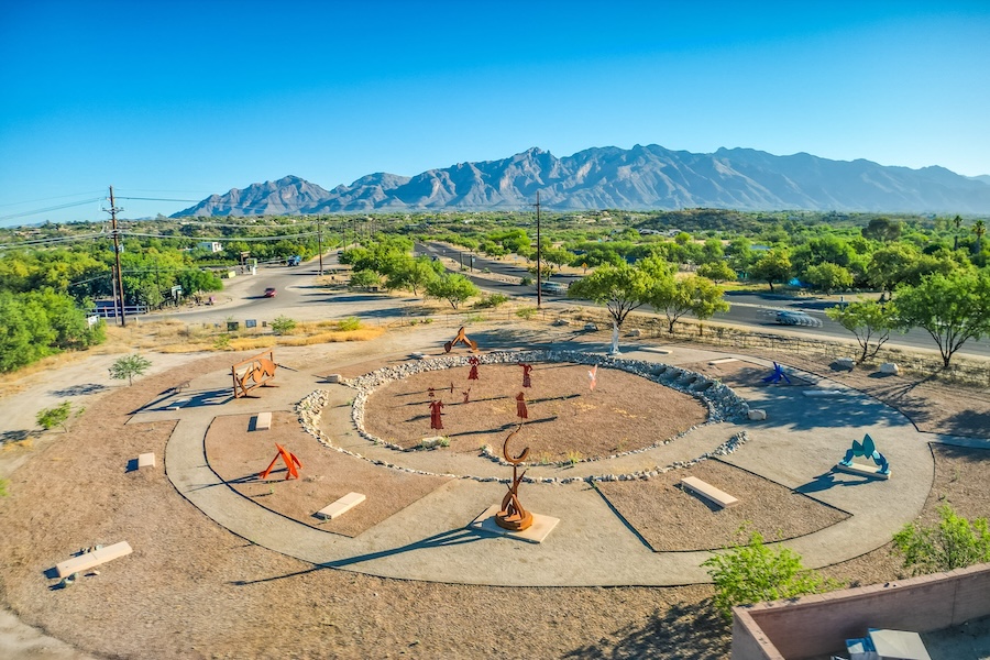
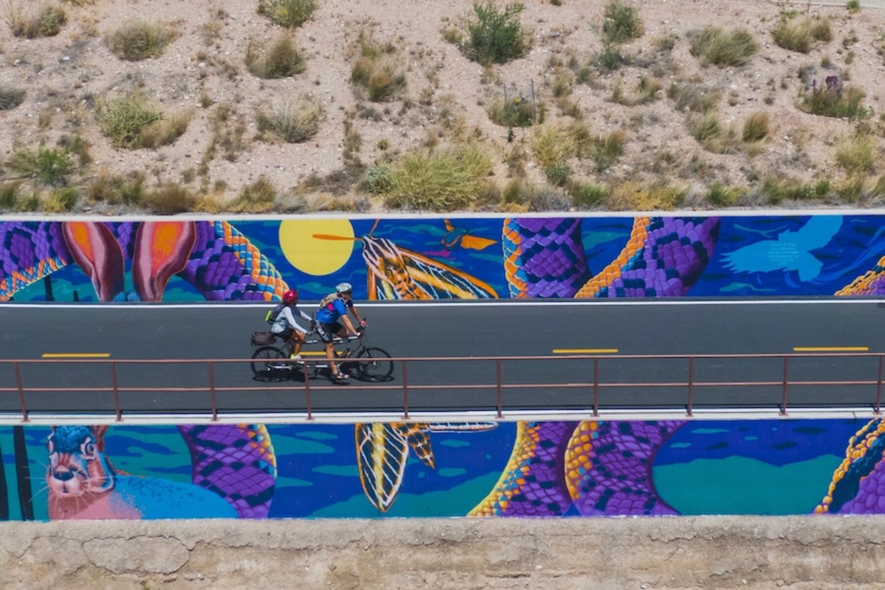
Although art is plentiful along the entire loop, the Rillito River section boasts its largest concentration: more than three dozen artworks—including sculptures, murals and even labyrinths—line the path, serving as a veritable linear gallery.
In 2023, the trail became home to the newly completed Tracks and Trails mural—Tucson’s largest to date, at 4,000 square feet—covering the retaining walls along the Rillito River’s north bank. The vibrant painting depicts the relationship between wildlife, vegetation and humans in the desert ecosystem.
“We used a hyper real color palette and a high level of detail, contrast and texture to create a sense of illusion, intended to physically draw visitors in as they journey down the trail, explained the mural’s artists Jessica Gonzales and Rock “CYFI” Martinez in an Instagram post. “Tracks and Trails is meant as both a symbol of unity and resilience, and reminds us of our shared commitment to protecting this natural resource for generations to come.”
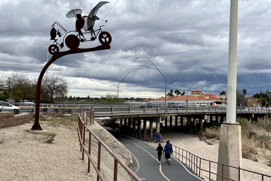
Another artwork, a quirky metal sculpture depicting a family of bats located on the south bank of the Rillito River at the Campbell Avenue Bridge, marks the spot where thousands of Mexican free-tailed bats roost in the summer, attracting crowds of bat watchers in the evenings.
Since about 1990, the artwork along The Loop has been funded through an ordinance that sets aside for public art 1% of the construction budget for capital improvement projects. The program, which was created to advance Pima County’s reputation as a cultural center for innovation and creativity, utilizes a public process for choosing the artworks.
“We make sure that the community members are there to review applicants and select the artists to work with, and then they go through a design phase,” explained Jeff DaCosta, Pima County’s art program manager for The Loop. Along with looking for pieces that can withstand Tucson’s extreme environment and heat, DaCosta added, “We want to have significant works that are wayfinding points that draw people in and emphasize this great asset which is The Loop.”
An Urban Oasis
While the vast collection of art serves to set the Rillito River trail apart from the rest of The Loop, it’s not the section’s only distinction. It’s also home to the busy St. Phillips Plaza shopping area and—within a short walk or ride—the Fort Lowell Museum and the Tucson Botanical Gardens. In addition, it’s directly adjacent to 10 parks and within close proximity of eight schools.
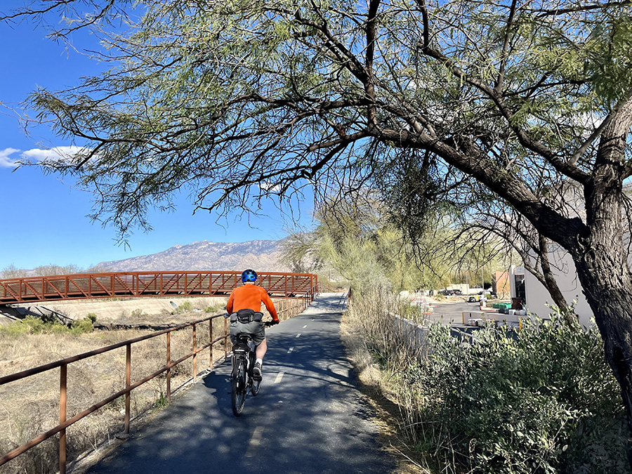
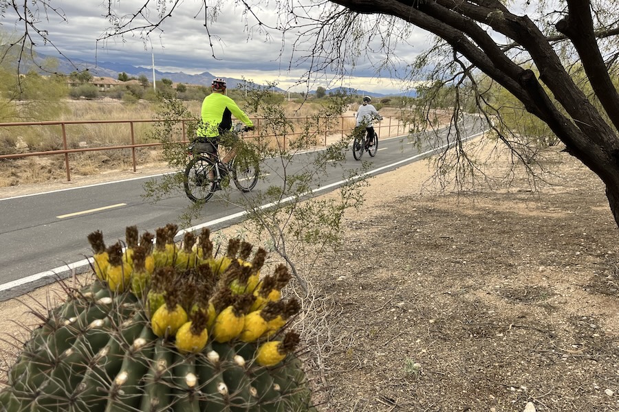
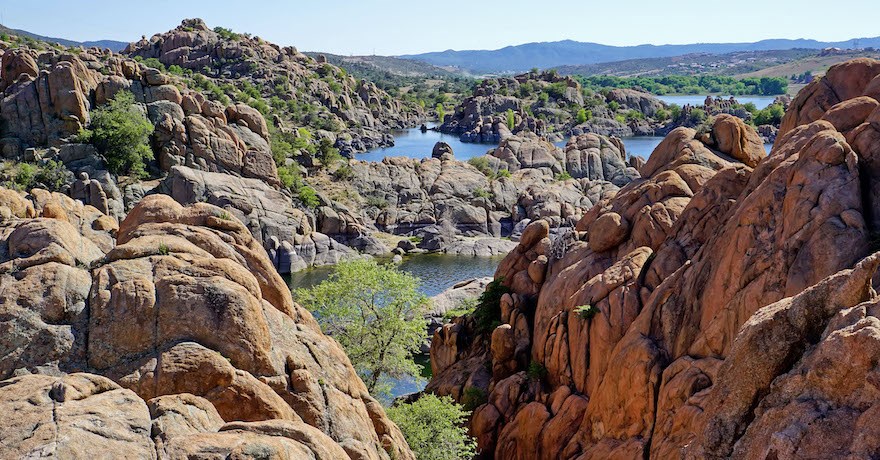
“Each section has its own geographic character,” DaCosta said of The Loop. “[The Rillito River section] is probably the most heavily trafficked. I think that has to do with its ideal location. It doesn’t run through the heart of Tucson, but it’s very scenic.” Along its route, the trail meanders through rugged desert terrain that transitions from spiky cacti to lush riversides, with rolling foothills as a distant backdrop.
After riding The Loop occasionally from his previous home in nearby Oro Valley, Randy Ford retired in 2021 and relocated to a house along the Rillito River Park Trail, where he took a renewed interest in The Loop. His regular rides turned out to be enjoyable for the exposure to the outdoors and desert air, as well as therapeutic for a lingering knee injury. “I blew my knee out years ago, and it’s gotten progressively worse,” Ford said. “But with a knee brace and a bicycle, I can cover a lot of ground.”
Ford soon found, however, that there was a lack of guidebook resources to help him along the way so he, ultimately, wrote his own guidebook, The Loop – America’s #1 Recreational Trail: Atlas and Guidebook. He notes that The Loop consists of a 54-mile “inner circle” of trails, as well as a number of branch trails. Along with the Rillito River section, this network includes the Santa Cruz section, Pantano River Park Trail, Julian Wash Greenway, Harrison Greenway and the Cañada del Oro River Park Trail.
Over the past four years, Ford estimates that he has ridden about 10,000 miles on the trail network. “I ride practically every day,” he said. “The Loop to me is like an oasis in the middle of an urban jungle.”
Building on Success
Like much of the rest of The Loop, the route that serves as the Rillito River Park Trail was not originally intended as a recreational trail. Rather, the pathway dates back to flood-control measures that Pima County took decades ago, starting after devastating flooding occurred along the region’s largely seasonal rivers in the 1980s.
“The Loop was constructed because of a flooding project that the regional flood control was levee-ing in a lot of areas,” explained Norton. “People were riding their bikes and walking along [the soil-cement bank protection], and the county administration decided this would be a perfect opportunity to put in these trails.”
Since then, The Loop has become a popular amenity with Pima County Parks and Recreation reporting that about 7.5 million people used the trail network in 2023. And with its increased value, finding more transportation options that tie into The Loop has become a priority.
“If you look at a map of The Loop, it’s kind of a big circle around the city, so having east-west, and north-south connections where people can safely bike or walk around the city is important,” said Lydia Barker-Winkworth, a transportation planner for the City of Tucson. “One of the things we really focus on is making sure we are connecting schools, parks and jobs.”
That’s where the city’s “bike boulevards” come in. Barker-Winkworth says an effort has been ongoing since 2017, when the citywide Move Tucson transportation plan was approved, to create street access to get cyclists and walkers to the safer and more accessible Loop trails.
“Bike boulevards use low-volume, low-speed residential streets and add traffic-calming features like speed humps, traffic circles, wayfinding signs and curb-outs with vegetation,” she said. “These are not bicycle lanes, but they allow bicyclists to share the streets safety with vehicles.”
Two of the main bicycle boulevards that connect with the Rillito River trail include Dodge Boulevard and Treat Avenue, both of which focus on helping people to get out of their cars and onto bikes to get to work, said Barker-Winkworth, whose own daily commute includes The Loop.
Additional efforts are in the works to expand and improve The Loop and other recreational facilities in the region with the development of a new countywide Parks and Recreation Master Plan to update the existing 2004 plan. Its findings, which will take into consideration public input, are expected to be presented to the county’s board of supervisors by the end of 2025.
“It’s going to shape the future of the parks and recreation projects for the next 10 to 15 years,” Norton said.
Related Links
Pima County’s Rillito River Park
Trail Facts
Name: Rillito River Park Trail
Trail origin: The Rillito River Park Trail, along with other portions of the contiguous Chuck Huckelberry Loop, evolved from Pima County Flood Control efforts taken after devastating flooding occurred in the region in the 1980s. Today, trails on both sides of the river are used for recreation, as well as for flood control efforts and maintenance.
Trail website: Pima County’s Rillito River Park
Length: 22.4 miles
County: Pima
Start point/end point: 3608-3698W. River Road, adjacent to I-10 (Tucson) and N. Craycroft Road on the north and south banks of the Rillito River (Tucson)
Surface type: Asphalt
Grade: Following the path of the seasonal Rillito River, the trail is mostly flat, except for slight inclines approaching underpasses.
Uses: Walking, bicycling, inline skating, horseback riding; wheelchair accessible
Difficulty: With its smooth asphalt surface and a mostly flat grade, the trail is rated as easy.
Getting there: The closest airport is the Tucson International Airport (TUS), which is located about 14 miles south of the Rillito River Park Trail’s northern end at I-10 and West River Road. About a 1.5-hour drive to the north, the Phoenix Sky Harbor Airport offers most major airlines with dozens of nonstop flights. Tucson is also served by Amtrak, which stops at the Tucson Amtrak Station (400 N. Toole Ave.) in downtown Tucson.
Access and parking: Access and parking are available at numerous locations throughout Tucson, including Brandi Fenton Memorial Park (3482 E. River Road); the trail’s eastern terminus just west of N. Craycroft Road; Rillito River Park (4200 N. Campbell Ave.); and Rillito Regional Park (4502 N. First Ave.).
To navigate the area with an interactive GIS map, and to see more photos, user reviews and ratings, plus loads of other trip-planning information, visit TrailLink™, RTC’s free trail-finder website.
Rentals: Tugo Bike Share offers 41 stations and 330 bikes across 13 Tucson neighborhoods, available 24 hours a day, seven days a week. A number of stations are located near the Chuck Huckelberry Loop, which includes the Rillito River Park Trail. Other bike rental options are listed on the Friends of The Tucson Loop website.


Donate
Everyone deserves access to safe ways to walk, bike, and be active outdoors.