Hawai’i’s Ke Ala Hele Makālae
Trail of the Month: September 2024
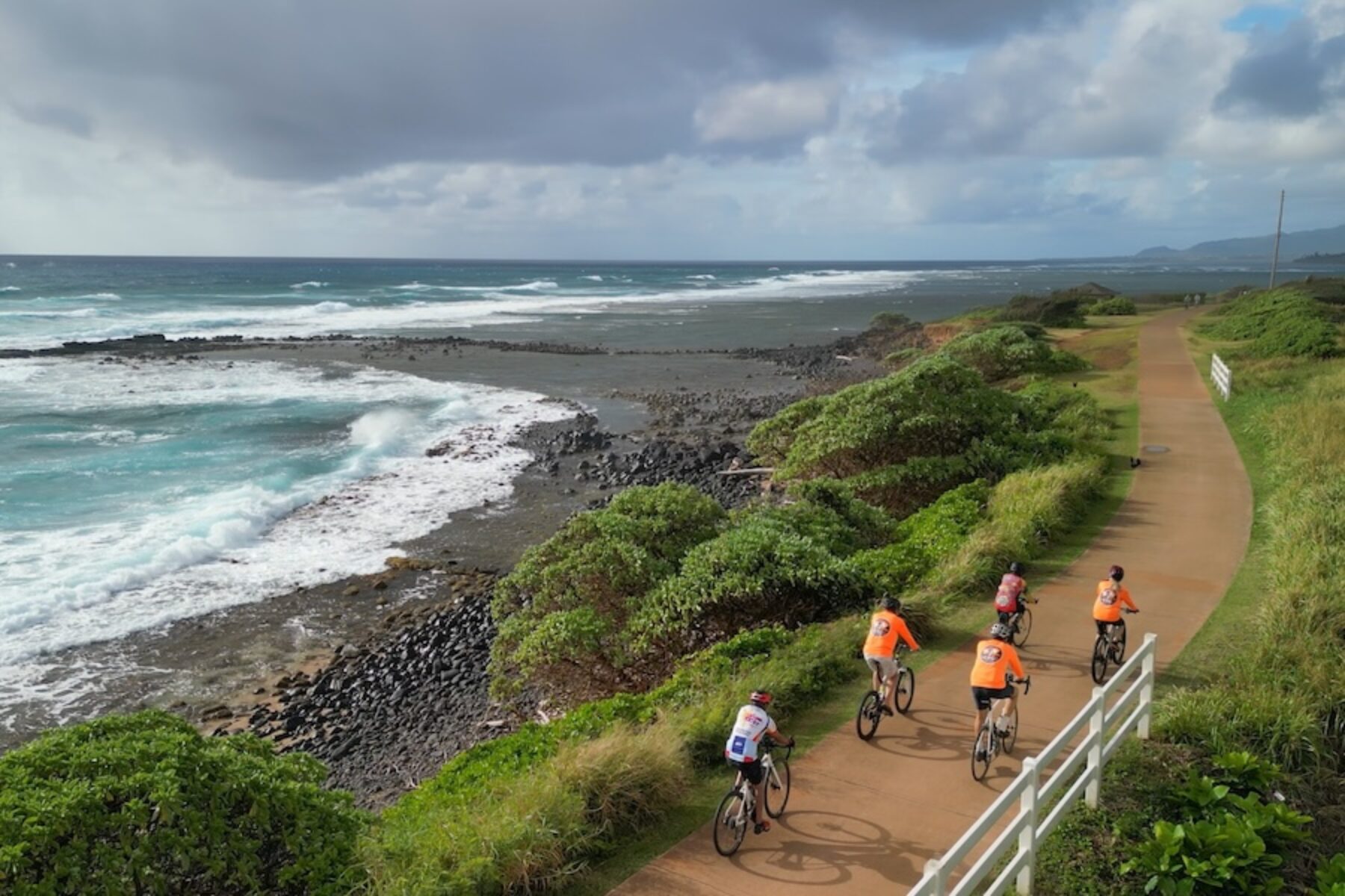
Hawai’i’s Ke Ala Hele Makālae, which runs for about 8 miles along Kaua’i’s splendid Coconut Coast, was inducted into Rails to Trails Conservancy’s Hall of Fame this summer by securing nearly 45% of the public vote. The induction puts Ke Ala Hele Makālae in the company of several dozen exemplary multiuse trails all over the country that have been celebrated for their social, economic and quality-of-life impacts.
Growing up on Hawai’i’s Island of Kaua’i, Franny Johnson was aware at a young age of the dazzling appeal of the island’s east coast, with its rugged cliffs, crashing surf and sandy beaches.
“I grew up in Kapa’a Town, and we’ve all known what this area was because our dads and grandparents would take us fishing along here, along the coastline,” Johnson said, noting that the ocean was valued as a source for food, and also as a spot for recreation and reflection.
So, she remembers being happy about the idea of a trail in the area because she saw it as a way of preserving ocean access for the public, which might otherwise have been cut off by private resorts. Over the years, Johnson has watched with pleasure as the paved route known as Ke Ala Hele Makālae has flourished.
Johnson, a native Hawaiian who has owned the family-run bike shop Hele On Kaua’i Bike Rentals for the past 18 years, said Ke Ala Hele Makālae has lived up to the hopes she had at the beginning.
“It’s just a spectacular asset for everyone,” she said.
“It is probably one of the best unsung heroes of this whole island, with some of the best views you can get of the ocean anywhere on the island.”
—Monique Tucker, general manager of Java Kai
‘Unsung Hero of the Whole Island’
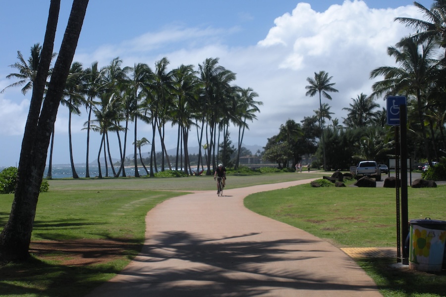
Another enthusiastic advocate is Monique Tucker, the general manager of Java Kai, a coffee shop near the trail, and a regular user of Ke Ala Hele Makālae.
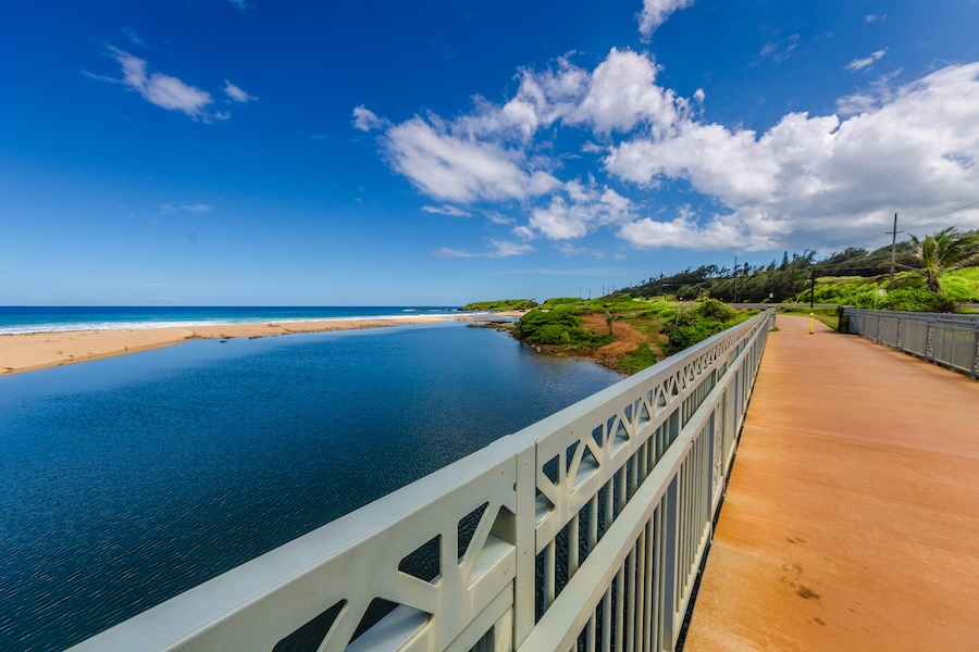
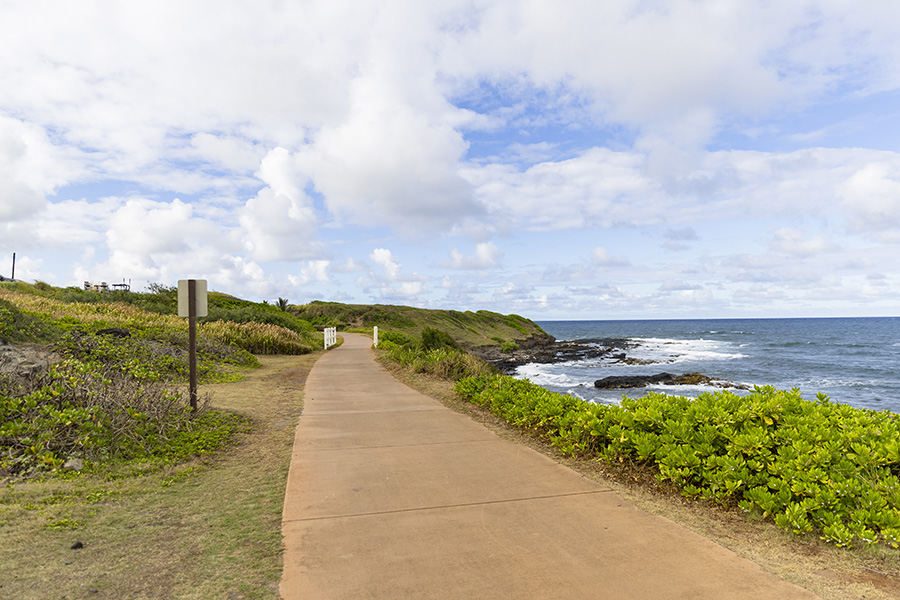
“Honestly, any chance I get to highlight or spotlight that trail, I am absolutely delighted,” Tucker said. “It is probably one of the best unsung heroes of this whole island, with some of the best views you can get of the ocean anywhere on the island.”
While most island residents are well aware of the treasure that is Ke Ala Hele Makālae, Tucker said visitors are often unaware. “I send people over to rent bikes and ride the trail all the time,” she said. “The trail is just stunning. We’re lucky to have it.”
Bike-rental customers at Hele On Kaua’i often return from their rides blown away by the experience. “They can’t believe how beautiful it is,” Johnson said. “They literally come back and say, ‘How in the world did they decide to build this?’ It’s along the ocean, and it’s just beautiful.”
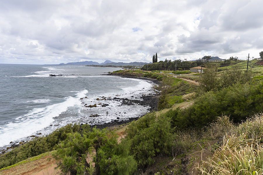
Dave Haggland, a five-year resident of Kaua’i and a railroad history buff, rides Ke Ala Hele Makālae at least two times a week, and says the experience continues to amaze him.
“You take a bike up that path and get up on the north end, and there’s nothing out there but pretty much all wild Hawai’i surf line along rocky lava cliffs,” Haggland said. “You’re getting the ocean air, and you’re getting the crashing surf. It’s pretty nice on a bike; if you haven’t done it, I highly recommend it.”
Along the way, nearly two dozen interpretive signs also dot the pathway, allowing people to learn about local archeological, cultural and historical sites, the Native names of streams and canals, the plants and animals that can be seen here, and other topics unique to the area.
A Community Asset
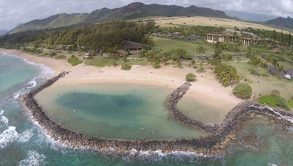
Advocates of the trail credit several early community leaders with the vision for Ke Ala Hele Makālae, which translates to “The Path that Goes by the Coast.” Tommy Noyes, executive director of the nonprofit organization Kauai Path, Inc., said former Kaua’i County councilmember, and later mayor, Bryan Baptiste was an early advocate, with a motivation of protecting lateral coastal access in perpetuity.
“Our island is a visitor destination, so people were developing resort facilities along the coast, and traditional and customary fishing and gathering was being threatened by displacement,” Noyes said.
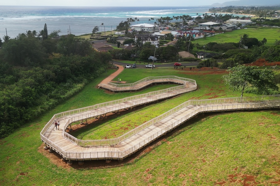
In large part, those early preservation efforts were successful. Today, Ke Ala Hele Makālae runs from Lydgate Beach Park in the south to Kuna Bay (Donkey Beach) in the north. Loosely parallelling Route 56 (Kuhio Highway), the trail provides an alternative to one of the island’s busiest roadways and connects the coastal communities of Ahihi Point, Wailua Beach Park and Kapa‘a. The trail also links up with the Kawaihau Elevated Boardwalk, providing the most densely populated residential area on the island with access to the coast.
Alden Alayvilla, public information officer for the Office of the Mayor, notes that the vision for the trail dates back to the 1990s, when the objective was to create a safe, scenic route that would connect coastal communities and promote healthy living—goals that have been realized through the years.
“Ke Ala Hele Makālae, envisioned by former Mayor Maryanne Kusaka, has significantly enhanced the well-being of Kaua’i’s keiki (children), kūpuna (elders), visitors, families and the broader island community,” Alayvilla said. “For keiki, the trail provides a safe and accessible place for outdoor activities, encouraging physical fitness and a love for nature from a young age. Kūpuna benefit from the gentle, scenic pathway that promotes regular exercise and social interaction, crucial for maintaining good health and reducing isolation.”
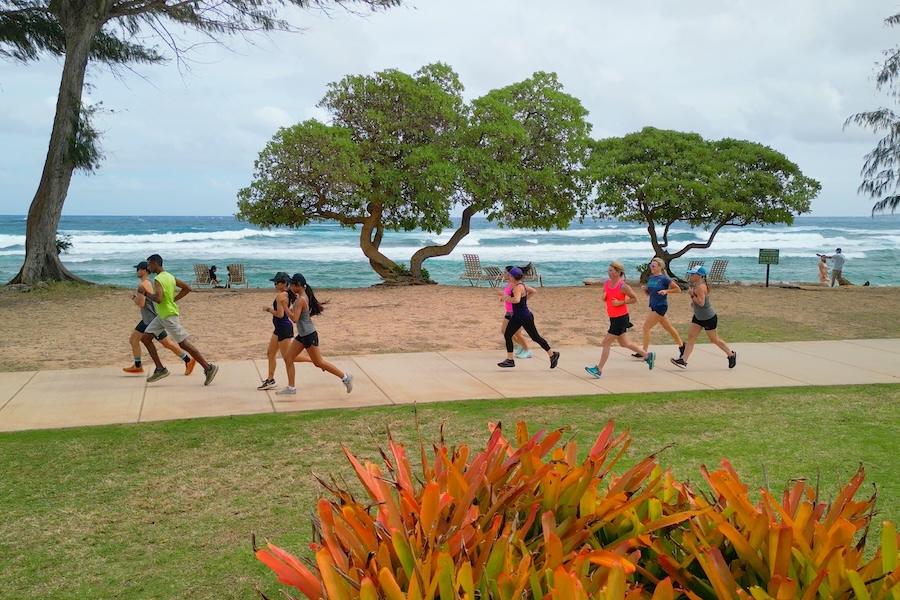
Although the county does not have specific annual usage numbers, Alayvilla said, “It’s estimated that Ke Ala Hele Makālae sees tens of thousands of users annually. The trail is popular year-around with both residents and visitors, who use it for recreation, exercise and transportation.”
Noyes, who was hired by the Hawai’i State Department of Health to manage an American Reinvestment and Recovery Act grant for a program to help combat obesity, said the trail has been central to an effort to improve the health and well-being of the community.
Along with the health benefits from exercise, Noyes explained, “The social aspects are huge. If it’s easy to get off your couch, take your dog, or walk a few miles on the path, you’re going to have the benefits of not only getting out in fresh air and moving your body, but you’re going to see your friends, and you’re going to have social connections that would not exist were that facility non-existent.”
Pursuing a Vision
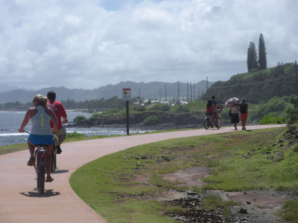
Certainly, the effort to protect the valuable coast was never easy. In the early days, Noyes remembers hearing from detractors who testified during hearings about “how silly it was to build a path to nowhere that diverted funds from fixing potholes on our highways that were congested.”
But trail advocates persevered, first opening a short section within the regional Lydgate Beach Park in 2004, and then using the 1920s-era “haul cane corridors” that remained from the sugarcane industry and pineapple cannery that had once used the route to haul freight along the Ahukini Terminal & Railway Company.
“Phase Two was primarily following haul cane corridors,” Noyes said. “That was opened in 2008.”
The vision for the future of the trail is to nearly double the current 8 miles, to about 17 miles, Noyes said. Future sections are proposed to run south of Lydgate to the commercial center of Līhu’e (home to the island’s seat of government and the airport), and ultimately to Nāwiliwili.
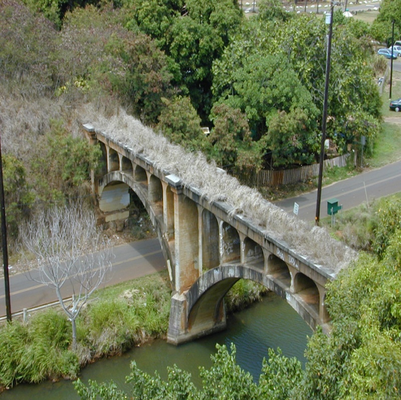
The trail is also proposed to cross the Hanamaulu Stream over the beautiful concrete arched Hanamaulu Bridge that dates back to the 1920s, when it was built for the railway. The bridge has been abandoned for at least 50 years and will require a significant amount of work, Noyes said, adding, “But it will be a really wonderful part of the trail.”
Plans are also in the works for a northern extension. “At this point in time, the north segment terminates in the middle of a vacant area,” Noyes said. “Ideally, it will continue to the small community of Anahola, although land-rights issues are still being resolved.”
Currently, there isn’t a projected date for when the expansions will be complete. “It’s a big slow-moving project, and it depends on what actually comes to fruition,” Noyes said.
Over the years, Ke Ala Hele Makālae has benefited from a number of significant federal grants and matches that were achieved through collaborative efforts, such as a soft match provided by sweat equity from volunteer labor.
“We’re just really proud of the collaboration we’ve managed to bring about with the County of Kaua’i, state and federal funding sources, the business community and the general population to achieve what we have so far,” Noyes said. “We only regret that it’s taking us so many decades to get as far as we’ve come. But we’re adamant in pursuing our vision.”
Related Links
Trail Facts
Name: Ke Ala Hele Makālae
Used railroad corridor: Portions of Ke Ala Hele Makālae follow the route of the Ahukini Terminal & Railway Company.
Trail website: Kauai Path
Length: 8 miles
County: Kaua’i
Start point/end point: The trail runs between Lydgate Beach Park in the south and Ahihi Point in the north, with much of the route following the eastern coast of Hawai’i’s Island of Kaua’i.
Surface type: The pathway consists mostly of smooth asphalt and concrete. The surface of the connecting Kawaihau Elevated Boardwalk is fiber-reinforced polymer, as is an at-grade section of about 300 feet in front of the Kauai Coast Resort in Waipouli. There is also a gap of about 800 feet yet to be improved in the Waipouli area that is sand and grass.
Grade: The grade is relatively flat and is ADA compliant, with several gentle inclines.
Uses: Walking, bicycling and inline skating; wheelchair accessible.
Difficulty: Rated as providing easy access to people of all abilities and fitness levels.
Getting there: Ke Ala Hele Makālae is located along the eastern coast ofKaua’i. The island’s main airport is Līhu’e Airport, which offers domestic, overseas and inter-island carriers, commuter/air taxi, air cargo, heliport (tour operators) and general aviation. The airport is about a 5-mile drive from the southern end of the trail at Lydgate Beach Park.
Access and parking: Ke Ala Hele Makālae can be reached from Kuhio Highway (Route 56), which runs roughly parallel to the trail. There are many places to park along the route, including the following parks (listed from south to north):
- Lydgate Beach Park, Leho Drive and Nalu Road (Līhu’e)
- Waipouli Beach Park, Kuhio Highway and Kaloloku Road at the Lihi Boat Ramp (Wailua)
- Kapa’a Beach Park, Kuhio Highway and Niu Street (Kapa’a)
To navigate the area with an interactive GIS map, and to see more photos, user reviews and ratings, plus loads of other trip-planning information, visit TrailLink™, RTC’s free trail-finder website.
Rentals: Located right in the center of the 8-mile Ke Ala Hele Makālae route and directly along the trail, Holoholo Bike Rental (4-1586 Kuhio Highway, Kapa’a) offers rentals of geared bikes, e-bikes and beach cruisers, as well as kayak rentals. For rentals near the beach and Ke Ala Hele Makālae, Hele On Kauai (4-1302 Kuhio Highway, Kapa’a) offers beach cruisers, trikes and e-bikes, as well as trailers and baby seats.

Donate
Everyone deserves access to safe ways to walk, bike, and be active outdoors.