Pennsylvania’s Schuylkill River Trail
Trail of the Month: March 2023
“We are interested in supporting trails as a platform to connect people to nature and clean waterways. Our hope is that over the long term, the more time people spend in nature and by the water, the more inclined they will be to protect these assets.”
—Jamie Quinn, watershed protection communications officer for the William Penn Foundation
People tend to know Philadelphia, the City of Brotherly Love, for its place in early American history, its institutes of higher learning, its sports teams and its cheesesteaks. But its rivers? Not so much—at least, not for much of the city’s history over the past few hundred years. As Philadelphia’s industrial footprint spread and its buildings climbed high, the Delaware and Schuylkill Rivers got tucked out of sight and became less and less accessible to the average citizen.
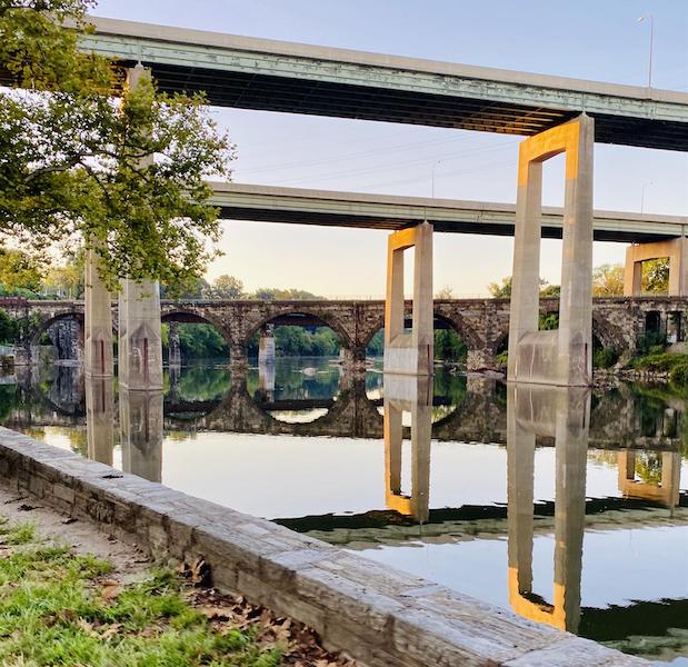
In recent years, however, community organizers and developers along the rivers have recognized the potential these natural conduits and their shorelines have for recreation, transportation, commerce and more, and they have invested heavily into their improvement for public use. One impressive result of these efforts is the Schuylkill River Trail (SRT), a multiuse path that will ultimately extend 120 miles between the small town of Frackville in east-central Pennsylvania and the confluence of the Delaware and Schuylkill Rivers in Philadelphia.
“This is where access meets equality and meets equity,” said Jordan Harris, state representative for Pennsylvania’s 186th legislative district, which includes part of the Schuylkill Banks portion of the trail in South Philadelphia. “Access to green space, access to the water and access for all, right here at Schuylkill Banks.”
History of the Waterway
“Schuylkill” (SKOO’-kel) is a Dutch word meaning “hidden river” or “sheltered creek.” The name comes from Dutch settlers, who found the mouth of the river overgrown with dense vegetation as they began to populate the region in the 1600s. The name still serves the waterway well, as it and the trail now running alongside it are still lesser-known gems of southeastern Pennsylvania that people discover for the first time every day.
Before the arrival of European settlers, the Delaware River watershed, which includes the Schuylkill River, was home to the Lenni-Lenape people for more than 10,000 years. A statue of Chief Tamanend, the leader of the Lenape’s Turtle Clan when William Penn arrived in 1682, stands at Philadelphia’s Front and Market Streets. As the population of settlers grew, the Lenape were driven out of the area.
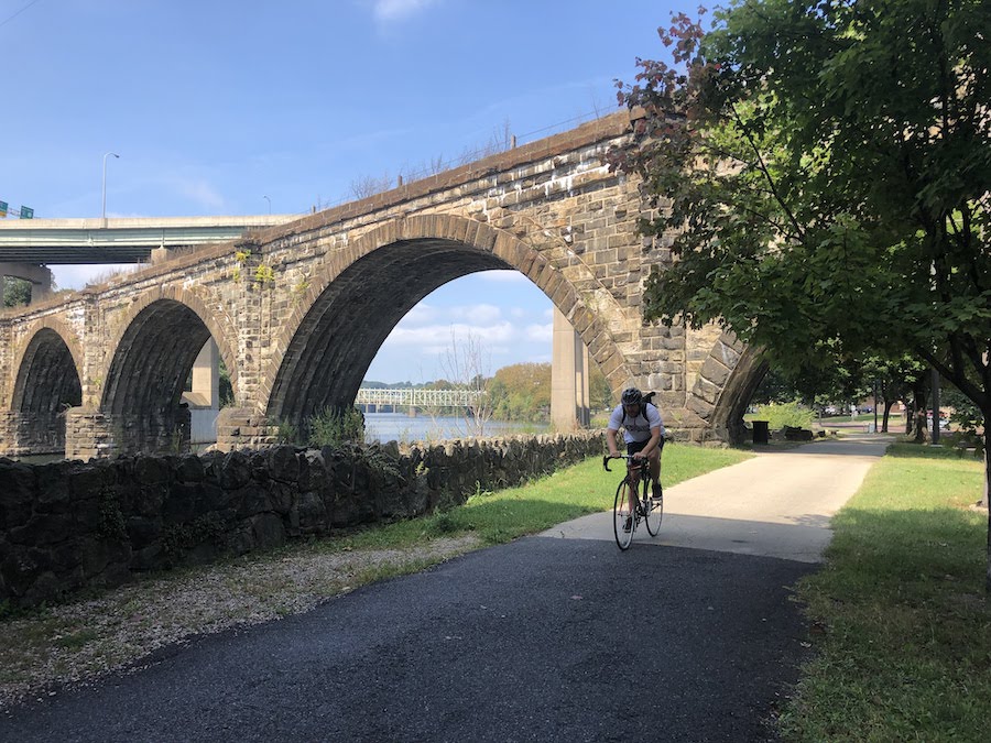
In the 1810s, the Schuylkill Navigation Company began building the Schuylkill Canal, a commercial waterway that would improve transportation and shipping opportunities along the Schuylkill River. Coal became a major industry across Pennsylvania, and the Schuylkill Canal carried it more than 100 miles from the mines near Pottsville in Schuylkill County to Philadelphia.
The competing Philadelphia and Reading Railroad opened a rail line alongside the Schuylkill in the 1840s and soon outstripped the canal’s capacity to quickly transport massive quantities of coal. After World War II, the Commonwealth of Pennsylvania filled in much of the canal, and today, only a few watered sections remain.
Fortunately, however, the former canal route and its corresponding rail corridors created an exceptional footprint for what would ultimately become the Schuylkill River Trail.
Trail Development
In 1974, a group of Reading-area citizens founded the Schuylkill River Greenway Association (SRGA) and developed plans to secure a scenic designation for the Schuylkill River. This would bring recognition to its rare, largely unspoiled nature, and they succeeded in 1978. After this initial achievement, SRGA turned its attention toward establishing and developing the Schuylkill River Trail. A number of communities and organizations along the route had already established short trails, and SRGA began working with these groups to unite these segments and create a long-distance corridor that would connect the region and honor its history.
In so doing, the organization also sought and secured state and national heritage area designations, which would bring broader attention to the offerings of the region, attract visitors, improve the local economy and open up SRGA and other trail partners for grants and land purchases. In 1995, Pennsylvania recognized the Schuylkill Heritage Corridor as a Pennsylvania Heritage Park, and Congress established the Schuylkill River Greenways National Heritage Area in 2000. In 2017, SRGA changed its name to Schuylkill River Greenways (SRG).
“We’re building this trail as land and money become available,” said Joseph Syrnick, president and CEO of the Schuylkill River Development Corporation (SRDC), which manages Philadelphia’s Schuylkill Banks section of the trail in partnership with Philadelphia Parks & Recreation. “It gets harder as we go down the river, but that doesn’t mean it isn’t going to happen.”
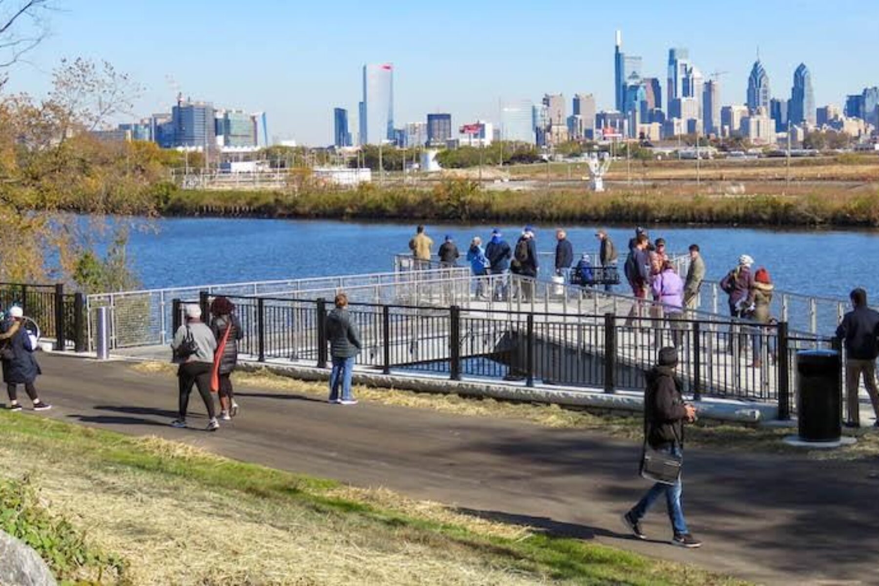
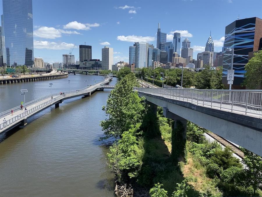
Between Philadelphia’s Locust and South Streets, trail managers and city planners came up with an innovative solution to the problem of land being unavailable. The train tracks still in use there run too close to the river’s edge to allow a trail, so trail partners built the 2,000-foot Schuylkill Banks Boardwalk, which runs above the river and has become a major attraction in the city.
One of the key funders of the trail’s development has been the William Penn Foundation, which has awarded SRDC more than $8.4 million over the past 10 years for projects along the Philadelphia portion of the trail. Most recently, it granted SRDC $3,227,000 for construction of the trail segment from Christian Street to Gray’s Ferry Crescent Park.
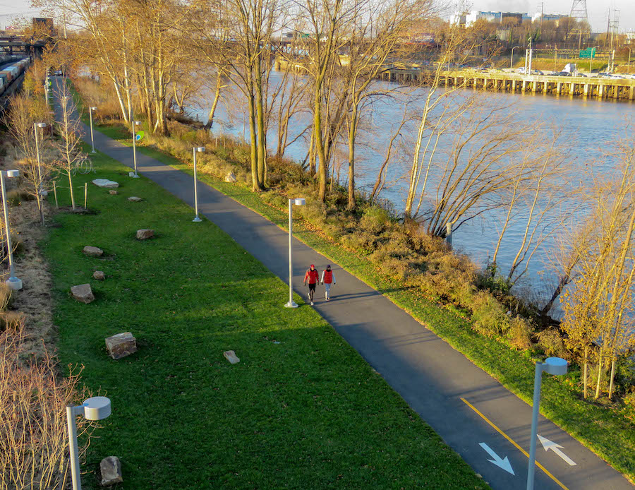
“Our interest in trails relates to clean water in the Delaware River watershed,” said Jamie Quinn, watershed protection communications officer for the William Penn Foundation. “We are interested in supporting trails as a platform to connect people to nature and clean waterways. Our hope is that over the long term, the more time people spend in nature and by the water, the more inclined they will be to protect these assets.”
In 2022, SRG and its partners in Chester County opened up a 2-mile section of trail south of Fricks Locks, which leaves a single 2-mile stretch remaining to be completed to make the trail continuous from Philadelphia to Reading, about 60 miles. SRG expects to have that portion completed by spring 2024, after which they will turn their full attention to completing the unfinished sections between Reading and Frackville and the last few miles in Philadelphia to reach the Delaware River.
In addition to the physical development of the trail, trail managers like SRG and SRDC have developed programming to engage the community with this shared resource. In Philadelphia, SRDC operates regular events like riverboat tours, kayak tours, movie nights and Fishing Fest, a popular annual catch-and-release competition open to all ages.
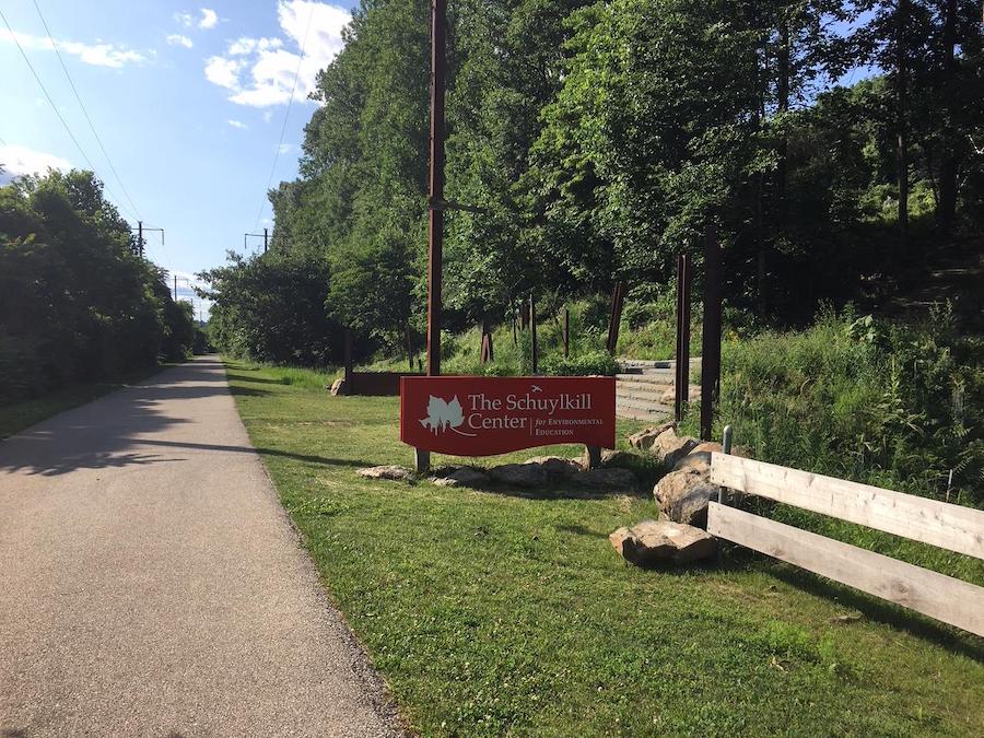
A Piece of the Pie
Although an impressive trail in its own right, the Schuylkill River Trail also plays a key role in several larger trails and trail networks. The Circuit Trails network is one of Rails-to-Trails Conservancy’s (RTC) signature TrailNation™ projects spearheaded by the Circuit Trails Coalition, and this system will ultimately span 800 miles of trails across nine counties in Pennsylvania and New Jersey. So far, 374 miles of the Circuit Trails have been established, and the project is expected to be complete by 2040. At that point, more than 3.1 million people—more than 50% of the region’s population—will live within a mile of the network.
Related: The Circuit Trails: 750-Mile Network Has Sparked a Greater Philly Transformation
“The Schuylkill River Trail is currently one of the most critical spines of the Circuit Trails and will continue to be so as the network grows,” said Anya Saretzky, RTC’s project manager for the Circuit Trails. “As connectivity across the region increases, trails become a more appealing and functional option for recreation and transportation, which will increase trail traffic.”
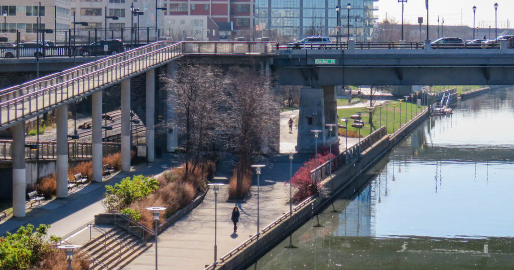
The Schuylkill River Trail is also part of other major trail networks, including the East Coast Greenway, which stretches more than 3,000 miles between Maine and Florida; the Appalachian Trail, a nearly 2,200-mile footpath spanning from Maine to Georgia; and the September 11th National Memorial Trail, a 1,300-mile multiuse loop that connects the World Trade Center in New York City, the Pentagon just outside Washington, D.C., and the Flight 93 Memorial in Southwestern Pennsylvania. In every case, the routes connect major population centers to smaller communities and offer opportunities for commuting and recreation.
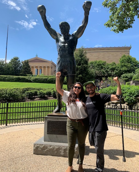
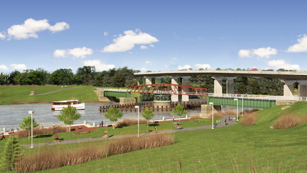
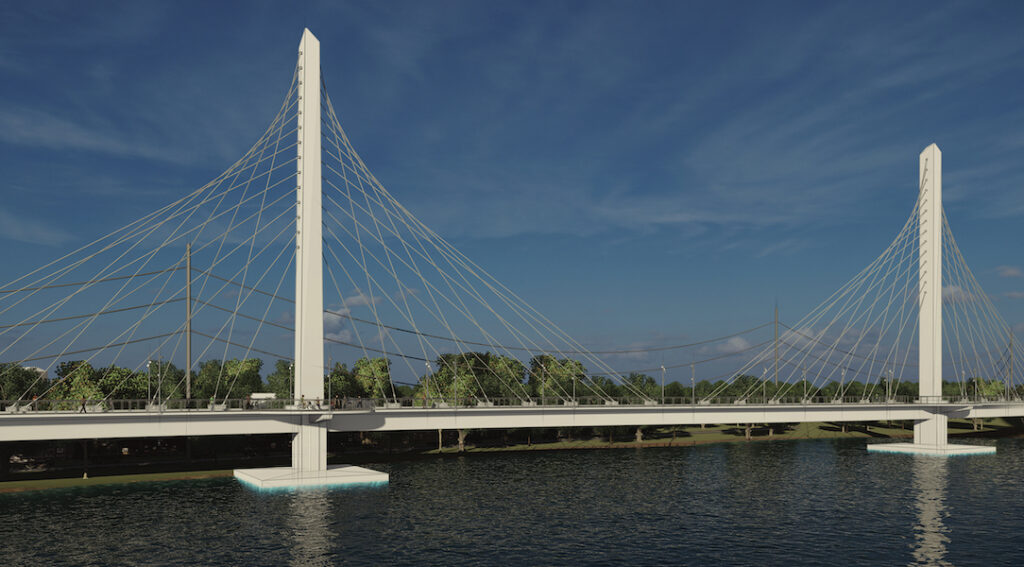
About 75% of the existing Schuylkill River Trail travels along former rail lines, and it runs adjacent to a number of attractions that draw trail users from near and far. In Philadelphia, the trail goes by the Philadelphia Museum of Art (home to the famous steps from the movie “Rocky”), Bartram’s Garden, The Woodlands and Fairmount Park. As it continues north, it passes Valley Forge National Historical Park, the GoggleWorks Center for the Arts, the Reading Railroad Heritage Museum and the Yuengling Brewery, to name just a few attractions. The trail itself also features some intriguing points of interest, like the in-progress Schuylkill Crossing Swing Bridge in Philadelphia, which will allow tall ships access upriver while providing trail users a safe, offroad connection over the Schuylkill.
Related: Trail of Tributes: September 11 Memorial Trail Honors America’s Fallen Heroes
What the Future Holds
With just under 80 miles of finished trail in place and approximately two-thirds of the overall project complete, the Schuylkill River Trail managers have a lot to be proud of, but they know their work is far from done.
Elaine Schaefer, executive director of Schuylkill River Greenways, notes that, in Schuylkill County, the group is currently working on the engineering and design of 4+ miles at the very top of the trail—from St. Clair to Frackville—as well as finishing a construction project in Auburn Township that will fill a gap in the Bartram section of the trail starting in Hamburg and ending in Auburn. Additionally, a feasibility study for the alignment of the SRT through Berks County is almost completed.
“With about 40 miles to build, it will take many different groups working simultaneously to finish the trail within the next decade,” Schaefer said.
That’s a challenge these trail managers are more than ready to meet, thanks to the enthusiasm of the communities they serve.
“We see the camaraderie and support of the trail community on a daily basis,” said Schaefer. “Our users have formed their own Facebook groups, they schedule outings together, and boy do they come out to volunteer when asked! We hear from many of our users that their time on the trail and the friendships that they have formed have really improved their quality of life.”

The Circuit Trails is an innovative, regional urban trail network connecting people of all ages to jobs, communities and parks in Greater Philadelphia and New Jersey. Currently in progress, the project will eventually encompass 800 miles of trails on both sides of the Delaware River, building upon the region’s existing active transportation infrastructure.
Related Links
- Schuylkill River Greenways
- Schuylkill River Development Corporation
- Philadelphia Parks & Recreation
- The Circuit Trails
Trail Facts
Name: Schuylkill River Trail
Used railroad corridor: Former rail lines along this route include the Reading Railroad Schuylkill and Lehigh Branch, the Pennsylvania Railroad Schuylkill Valley Line, the Reading Railroad Main Line to Philadelphia and the Reading Railroad Main Line to Pottsville. The SRT shares some segments of its corridor with the Norfolk Southern Railroad and the Reading Blue Mountain & Northern Railroad.
Trail website: Schuylkill River Greenways National Heritage Area
Length: 80 miles current, 120 miles proposed
County: Berks, Chester, Montgomery, Philadelphia, Schuylkill
Start point/end point: This developing route is not yet fully contiguous; please refer to schuylkillriver.org for more information about the route and details to help navigate the gaps.
- Proposed: Route 61 and Spruce Street (Frackville) to Fort Mifflin Road near I-95 (Philadelphia)
- Current: Route 61 near the Mall Road exit (Frackville) to S. 56th Street near Eastwick Avenue at Bartram’s Garden (Philadelphia)
Surface type: Asphalt, Boardwalk, Concrete, Crushed Stone, Dirt, Gravel
Grade: The trail follows the Schuylkill River and reflects the watershed landscape amidst rolling hills. It averages less than a quarter of 1% grade downhill from its northern end to its southern terminus in Philadelphia.
Uses: Walking, bicycling, inline skating, fishing and cross-country skiing; wheelchair accessible
Difficulty: The trail is generally rated easy, with flat, paved sections in Philadelphia and Montgomery County and packed gravel north from northern Montgomery County.
Getting there: The closest major airport is Philadelphia International Airport (8000 Essington Ave., Philadelphia), which borders the trail’s proposed southern terminus. Amtrak users can get to Philadelphia via the 30th Street Station at 2955 Market St., which is on the opposite bank of the river from the SRT and directly accessible to the trail via the John F. Kennedy Memorial Bridge.
Access and parking: The Schuylkill River Trail has more than 40 trailheads along its route, the majority of which offer parking. Schuylkill River Greenways offers an interactive map to help you find the best access points for you.
To navigate the area with an interactive GIS map, and to see more photos, user reviews and ratings, plus loads of other trip-planning information, visit TrailLink.com™, RTC’s free trail-finder website.
Rentals: Trail users can borrow a bike for free from the Bike Pottstown/Bike Schuylkill bike-share program at multiple locations in Pottstown and Hamburg. In Philadelphia, Wheel Fun Rentals offers a variety of bikes (including tandems, surries, kids’ bikes, electric bikes, and adult tricycles and quadcycles) at Boathouse Row (1 Boathouse Row, Philadelphia; 215.232.7778). Farther upriver, The Tricycle Shop in Conshohocken rents e-bikes and also features a popular café just steps from the trail (1 Station Ave., Conshohocken; 484.533.3145).

Donate
Everyone deserves access to safe ways to walk, bike, and be active outdoors.
