Bridge to Everywhere: Examining Signature Gateways Across America
Across the United States, bridges are serving as the hallmarks, gateways and centerpieces of communities, providing connectivity that has a major impact on active transportation, tourism and economic development. Plus—there’s the view. Here, Rails to Trails spans the country to examine how bridges are transforming trails and regions.
“It will strengthen the view that if the public owns it, [they] should have access to it. And it will lead to more enthusiasm for further expansion of the lakefront access.”
—Dan Moore, Cleveland Metroparks Commissioner, on the Wendy Park Bridge
In a June 2021 speech celebrating the opening of the Wendy Park Bridge in Cleveland, Ohio, the surviving daughters of businessman and Cleveland Metroparks Commissioner Dan Moore recalled how their parents would go sailing on Lake Erie and anchor near Whiskey Island. Actually a peninsula, the mile-long strip of land was named for a distillery built in the 1830s. The land later came under railroad ownership, and by the 1980s, as The Plain Dealer’s Steven Litt described it, the area had become “a forgotten, weed-choked wasteland.”
It was also a key coastal natural habitat. More than 260 species of birds have been identified on the site, according to Cleveland Metroparks, and Halley and Heather Moore remembered their father recognizing this beauty and its potential during those sailing trips.
“He’d see it from his sailboat, and sometimes he and Mom would anchor by the Coast Guard station for the night and would marvel at the fact that you basically needed a boat, or to trespass, to get to that spot,” Halley Moore said at the dedication of the bridge that now solves that problem.
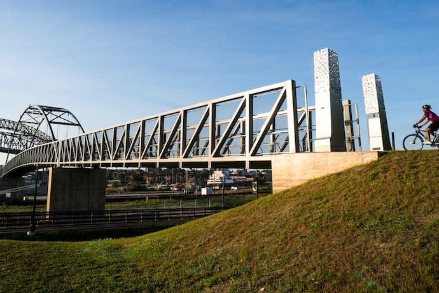
It was an effort decades in the making. Named for Dan Moore’s late daughter, Wendy, the Wendy Park Bridge carries people from the Cleveland Flats area across a set of railroad tracks to Whiskey Island’s Wendy Park. The park is also named for Wendy Moore, an avid birder, artist and outdoor lover. She died at age 29 in 1997 as a result of a skiing accident. In response to his daughter’s death, Moore’s company, which owns 36 patents, developed new helmet padding technology that he has said he hoped would save lives. (It has. It is now used by militaries.) Dan Moore purchased part of Whiskey Island from Conrail, and eventually sold it to Cuyahoga County, which then sold it to Cleveland Metroparks, which now manages the 22-acre green space known as Wendy Park.
Moore personally contributed half of the $6 million needed to build the 500-foot bridge. During his speech to celebrate the bridge opening, he often grew emotional as he talked about his late daughter, about the municipal battles over the ownership and future of the property that had to be fought in the decades leading up to Wendy Park’s development, and about the public’s right to access green space.
“The Metroparks have worked tirelessly to build this bridge and to link this incredible green corner to their trail system,” said Moore. “This bridge connects people to the lake. It preserves the green space on the Whiskey Island peninsula, and it’s a beautiful gem in the Emerald Necklace. Connecting Whiskey Island to the city with the Wendy Park Bridge will help the public better understand the need for public access to the lakefront. It will strengthen the view that if the public owns it, [they] should have access to it. And it will lead to more enthusiasm for further expansion of the lakefront access.”
Addressing Inequity and Access Through Connectivity
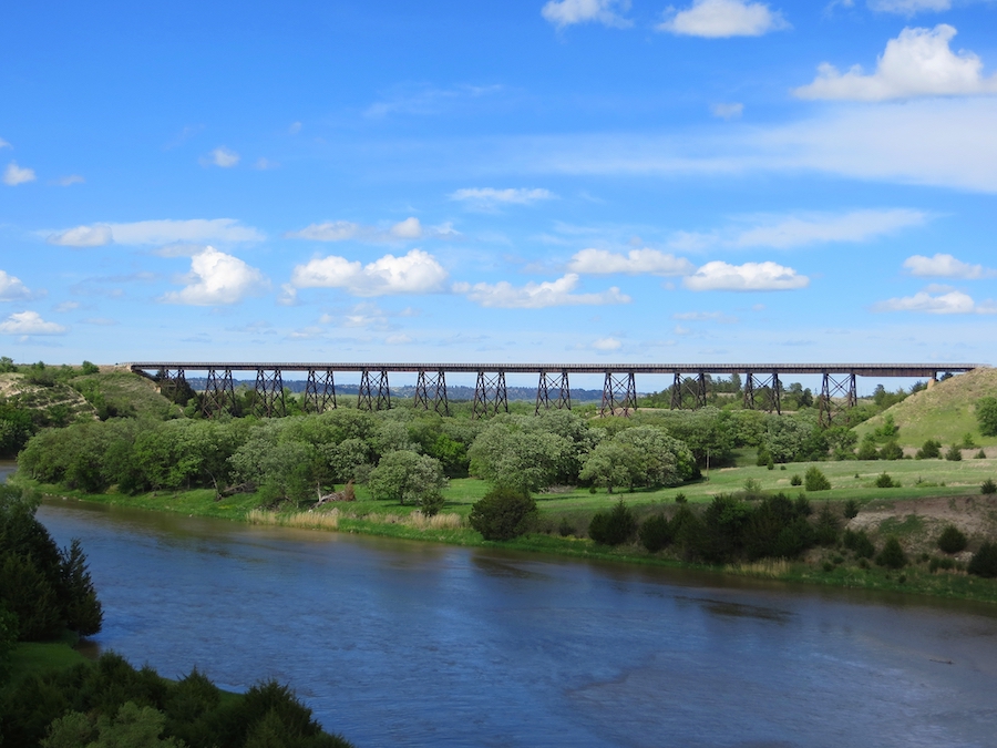
Bridges may not only serve as trail or trail network calling cards; they can also often represent a trail’s statement of purpose. In some cases, like that of the Cowboy Trail in Nebraska, for example, bridges literally make the trail. Some 200+ trestles and bridges dot the nearly state-spanning portion of the Great American Rail-Trail®, including a 148-foot-high stunner that crosses over the Niobrara River.
In providing connections across a once-impassable space, bridges and trestles can address environmental and equitable access concerns in areas where people otherwise would need motorized transportation to get from point A to point B. At the same time, they can be critical in linking together larger networks of trails, which serve as major tourism draws and economic engines.
The Wendy Park Bridge addresses a major inequity issue for public housing tenants in the revitalized Cleveland Flats neighborhood. According to Eric Oberg, Rails-to-Trails Conservancy’s (RTC’s) Midwest regional director, those housing complexes, and their residents, have been cut off from lakefront access for decades by interstate and shoreline development. Up until the Wendy Park Bridge opened, the only realistic way to access Whiskey Island was by car. Now, there is a walking and biking option to access the park, which offers sand volleyball courts, lakefront views and connections to an ever-growing trail network.
The Cleveland Foundation Centennial Lake Link Trail leads up to the bridge, and the Lake Link also connects with the Ohio and Erie Canal Towpath Trail that runs about 85 miles south from Cleveland down to New Philadelphia. The bridge, said Oberg, serves as a linchpin in the ambitious Industrial Heartland Trails Coalition trail network, a vision to connect 1,500 miles of trails in Ohio, Pennsylvania, West Virginia and New York.
“When you talk about the Cleveland–Pittsburgh corridor [of the IHTC] … the anchors of that entire corridor essentially are the riverfront in Pittsburgh and the Lake Erie shoreline,” Oberg said. “And you can’t touch the water in Lake Erie unless that bridge is there. That really is the enabler. It’s the key piece of getting people locally, regionally and nationally to the lakefront, and that just can’t be undersold, how important that is.”
Learn more about the 1,500-mile trail network envisioned by the Industrial Heartland Trails Coalition.
Getting There
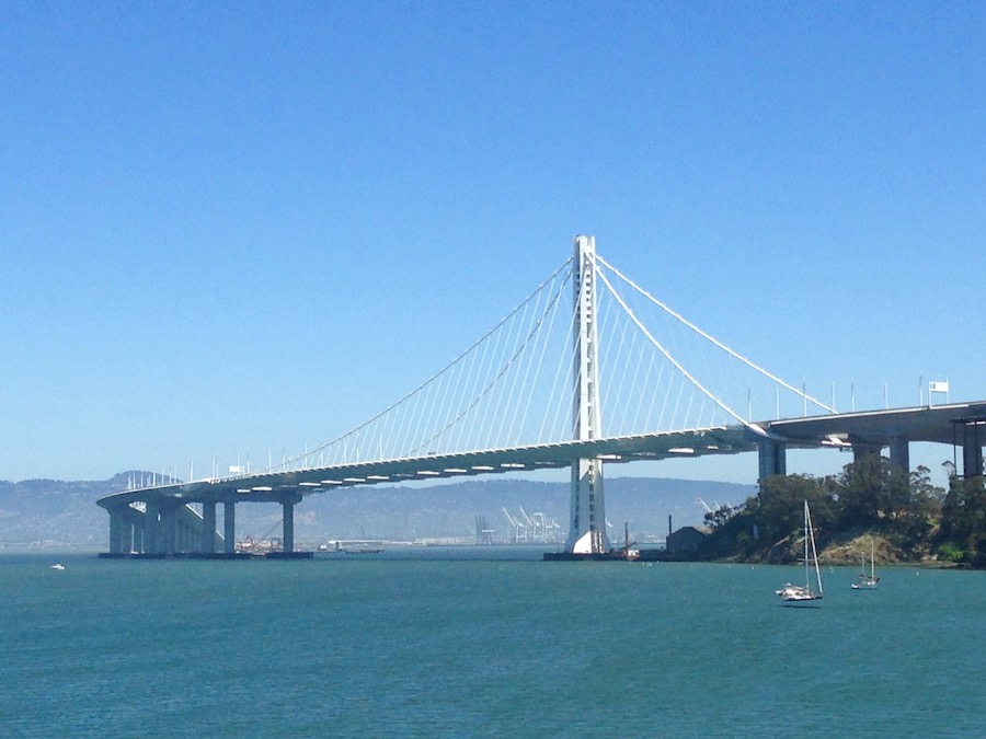
While the 500-foot Wendy Park Bridge serves as an enabler on Cleveland’s shoreline, trail advocates in California’s Bay Area are trying to bridge a much larger gap for a similar purpose.
Ben Kaufman, trail development manager for RTC’s Western Regional Office, is among those leading an advocacy effort to address the lack of pedestrian and bicycle options to get from San Francisco to the East Bay. The estimated $400 million Bay Skyway project—a 2.9-mile bike-ped path across the western span of the Bay Bridge connecting Downtown San Francisco, West Oakland, and Yerba Buena and Treasure islands—is a priority project of the 2,600-miles-plus Bay Area Trails Collaborative network, with a goal of providing more safe walking and bicycling options in an area hammered by traffic.
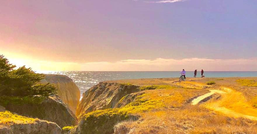
According to research, projections show that peak-hour demand in 2040 on the trans-bay corridor would be at about 150% of capacity, due in large part to an anticipated 25,000 new Treasure Island residents and 86,000 new jobs in San Francisco. In a Metropolitan Transportation Commission study, over 2,000 commuters are projected to use the bike path between San Francisco and Oakland in the peak hour in the coming years, accounting for 10% of all trans-bay vehicle trips, or the equivalent capacity of an existing travel lane.
Greater availability of electric bikes and bikeshare options would further accelerate the commute shift, enabling new ways for residents to safely access critical destinations on either side of the bay.
During the pandemic, climate concerns and rising gas prices stepped up this need, leading RTC to promote a quick build of walking and biking lanes across the Bay Bridge. It’s a strategy that has worked in one of the few comparable cities to San Francisco in terms of population density, New York. Car lanes converted to bike lanes on the Brooklyn Bridge have given people who relied on public transit another commuting option in the midst of the public health crisis. RTC continues to build support for a feasibility study and work with the collection of cities and state agencies linked to the bridge to advocate for the project.
The biggest issue? “Number one … there’s no mayor of the Bay Area,” Kaufman said. “The bridge is somewhat of a no-person’s land in terms of who takes ownership of it.”
Kaufman said engineers who have studied the Bay Bridge for decades estimate that the quick build would cost about $10 million.
“It’s a cheap and quick way of providing a connection for people,” Kaufman said. “It fulfills [the Bay Area Trails Collaborative’s goals] of filling this essential gap in the network, that probably is the most important gap in the network because of the sheer number of people that it connects from their homes to their destinations. And it’s a way to address our climate crisis.”
Learn more about the 2,600-mile vision of the Bay Area Trails Collaborative.
Connections Can Build After the Bridge Is in Place
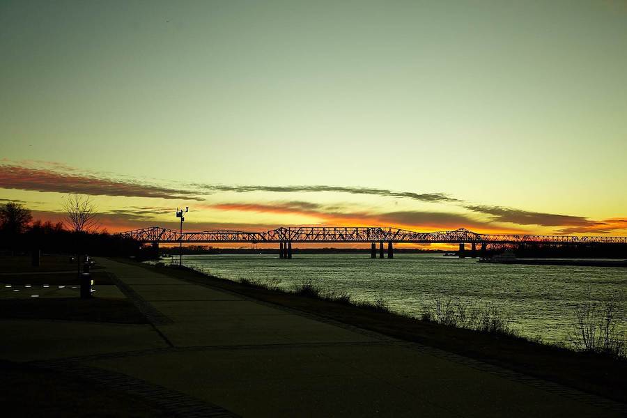
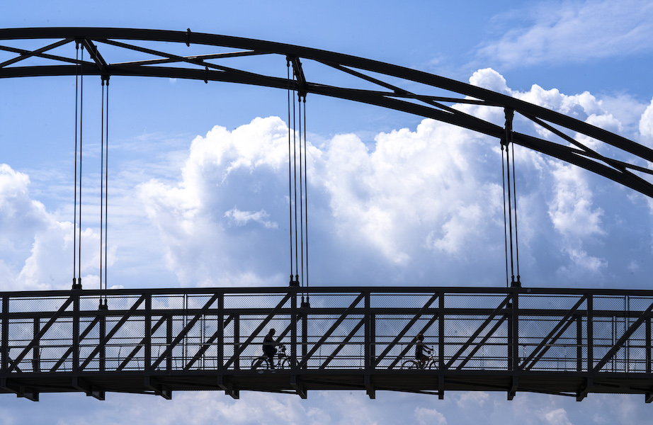
Oftentimes, trail networks build and build toward an impassable crossing, and eventually, after years or sometimes even decades of dreaming, planning, fundraising and partnership building, a bridge is built or retrofitted to provide people the connection they long sought. That process has been taking place in something of a backward manner in the Memphis region since the fall of 2016. That’s when the 4,973-foot-long Big River Crossing, or BRX, opened to pedestrians, allowing people to safely cross high above the Mississippi River on a bridge that also hosts an active Union Pacific rail line.
Similar to the Big Four Bridge that lets pedestrians cross from Louisville over the Ohio River to Jeffersonville, Indiana, or the Purple People Bridge that spans a half-mile across the same river, linking Cincinnati and Newport, Kentucky—the Big River Crossing has become a metropolitan landmark and a draw for tourists.
“The impact of the Big River Crossing on our region is endless,” said Paul Luker, West Memphis director of planning and development. “From the Big River Trail expansion and levee-top experience through the Arkansas delta to dynamic Mighty Lights shows that commemorate and celebrate causes and holidays each night, we’re giving locals and visitors a space to enjoy and experience sunup to sundown.”
The BRX, formerly known as the Harahan Bridge, is a key connector for cyclists and pedestrians to travel from Main Street in Memphis to Main Street in West Memphis, Arkansas, or vice versa. And the bridge has been instrumental in the development of the trail and park network that is sprouting in the wetlands surrounding it, said Dow McVean, president of McVean Trading and Investments and a longtime supporter of the Big River Strategic Initiative.
The BRX serves as the major trailhead for the 70-mile Big River Trail, a gravel path that runs atop the levee alongside the western bank on the Mississippi from West Memphis down to Marianna, Arkansas.
As with many pedestrian crossings, the dream of converting the Harahan Bridge into a trail path dates back decades. It was an idea that McVean’s late father, Charles, happened upon later in his life when the commodities trader and Memphis civic leader took up cycling.
In the process of exploring bike-friendly areas surrounding Memphis, Charles McVean heard more about the effort that began in the 1970s to create a hiking/biking path on the historic Harahan Bridge. In 1916, the train trestle opened for rail traffic; a year later, two one-way traffic lanes would be added for automobile traffic.
By the 1940s, as the region developed and automobile ownership grew exponentially, traffic grew with it and the bridge eventually closed to non-rail traffic once the Memphis and Arkansas Bridge opened.
Major federal dollars are often needed to get pedestrian bridges to the finish line, as they can be the most complicated pieces of the trail puzzle. The project costs realistically start in the millions of dollars. Different cities or states often reside on each side of the crossing, adding even more concerned parties to a list that likely already included a department of transportation or two, teams of engineers and, in the case of a retrofitted bridge, a rail company. [There’s a reason that one of the Memphians I spoke to about the BRX project thanked their lead lawyer, Charlie Newman, by name.]
In the case of the BRX, the trains never stopped. Union Pacific still uses the bridge as a Mississippi River crossing point, meaning that any conversations about making the Memphis-area bridge a pedestrian crossing would have to begin in Nebraska. Dow said his father chartered two planes filled with the area’s civic and political leaders and headed to Omaha, Union Pacific’s headquarters. There, they pitched then-chairman James Young on the Big River Crossing idea.
“It was a miracle that Dad was able to convince Chairman Young to let him do it, and then that was the beginning,” McVean said. “Then it was also quite a long shot to get a federal TIGER grant to pay for about $15 million of the $22 million needed to build the bridge. Less than 2% of those grants are awarded. So that was another long shot.”
Charles McVean died in the summer of 2021, after nearly a million people had already crossed the pedestrian and bicycle crossing he worked with countless others to see come to light. Dow McVean said the bridge is now a major draw, not only for Memphis and West Memphis residents in search of recreational opportunities, but also for tourists who are drawn to the intricate light displays that illuminate the BRX at night. The bridge has also become a magnet for train buffs.
“[Union Pacific] had a lot of [safety] requirements, let’s just put it that way,” McVean said. “So the end result was [that] the thing was over-engineered and over-built, and so it feels extraordinarily safe, stable and solid. So the experience is fantastic. [You also] get four-wide barges fighting the current, coming through there under the bridge. There’s not much neater than being out there and having a Union Pacific train come by while [having] a barge going underneath and a FedEx DC-10 on descent into the Memphis airport. It’s just really cool.”
The Big River Strategic Initiative, thanks in part to a $1.2 million donation from the Walton Family Foundation, is in the process of adding 42 more miles to the trail, connecting Marianna through the St. Francis National Forest and on to Helena-West Helena, Arkansas. Closer to the bridge, additional projects are in the works too. The Memphis-based wetlands conservation organization Ducks Unlimited, with a $1 million donation from First Horizon Bank and support from numerous other area stakeholders, including TennGreen Land Conservancy, is leading the Big River Park Conservancy project.
“The Mississippi River is an integral part of our footprint—economically, geographically and culturally,” said Bryan Jordan, president and CEO of First Horizon Corporation, who emphasizes that the investment and partnership are focused on restoring, protecting and enhancing “the natural features that make this community landmark so special.”
Specifically, the partners aim to restore wetlands and develop a network of trails through a 1,500-acre parcel in the Mississippi Delta. The park lies in a floodplain, giving recreation and conservation proponents a unique opportunity to preserve and enhance a natural area about 5 miles from downtown Memphis, rather than having seen it developed into an industrial eyesore decades ago, said McVean.
“It gives us a great opportunity to restore the wetlands, provide habitat for waterfowl and wildlife, and provide environmental benefits, all while supporting the communities surrounding this critical waterway,” said Adam Putnam, CEO of Ducks Unlimited.
McVean said none of this development would have happened if not for the effort to make the BRX accessible to people.
“It’s 100% of it,” said McVean. “There would be no trail system or park without the Big River Crossing, in no uncertain terms. First of all, accessibility would be very, very difficult for pedestrians and bikers. But it just simply wouldn’t be without the Big River Crossing.”
The Bridge Becomes the Draw
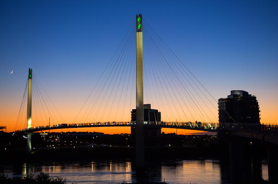
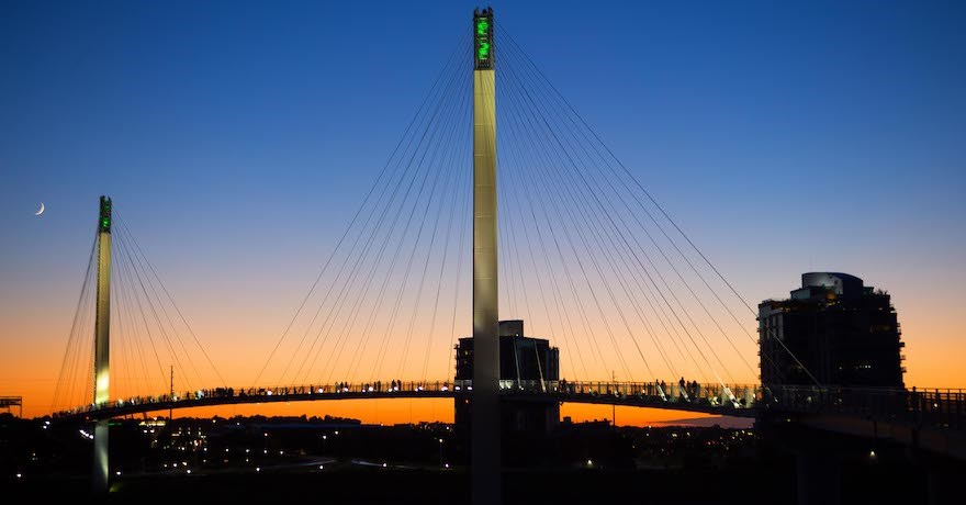
Sometimes the bridge becomes its own destination. As Deborah Ward, the current executive director of Visit Omaha, told the TrailBlog in March 2020, some people declared the $22 million Bob Kerrey Pedestrian Bridge project to be a “bridge to nowhere” when it debuted. It didn’t link pedestrians directly to either of the downtowns, even though it did connect to the Iowa Riverfront Trail on the Council Bluffs side and to the 3-acre Omaha Plaza on the Nebraska side, which is a quick trip to the Omaha Riverfront Trail.
Now, projects are being built on both sides of the bridge. Council Bluffs officials in March announced plans for another bridge to the city that would include a pedestrian path, providing a 2-mile loop for people to cross to bridges. And in January, the first phase of the FIRST AVE trail project opened.
Once it’s complete, downtown Council Bluffs will connect to the Iowa Riverfront Trail, and on to Omaha thanks to “Bob,” as the Bob Kerrey Pedestrian Bridge is affectionately called by locals.
On the Omaha side, Bob is getting a major connection to the downtown area in the form of a short extension. The North Downtown Riverfront Connector Bridge project will cross two major pedestrian barriers (Riverfront Drive and the active Union Pacific Railroad tracks) to provide access to a portion of Omaha that includes restaurants, concert venues, theaters, an arena, the convention center and the ballpark that hosts the College World Series. Measuring all of one-tenth of a mile, the bridge extension has been aptly dubbed “Baby Bob.”
The Baby Bob extension was value-engineered out of the original Bob Kerrey Pedestrian Bridge and was revived as a new project in the downtown Omaha master plan that was adopted in 2010. In December 2011, the first grant submittal was made, and in December 2013, the preliminary engineering started. The Baby Bob project will go to bid later this year, and construction will take place in 2023 and 2024.
“It will change the landscape from a tourist or recreational destination to a true transportation use for those wanting to access downtown from [Council Bluffs] by reducing travel time and providing a safer route. The project will also provide a crucial link to the Great American Rail Trail,” said Krista Wassenaar, design division manager for the City of Omaha, adding that the original project was key in fulfilling Omaha’s “Back to the River” efforts. In the meantime, Bob has become its own draw. “What’s fascinating now is people understand that the bridge is the somewhere,” Ward said. “People just flock there—it’s a destination.”
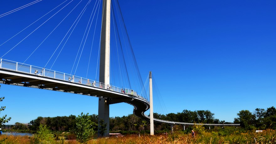
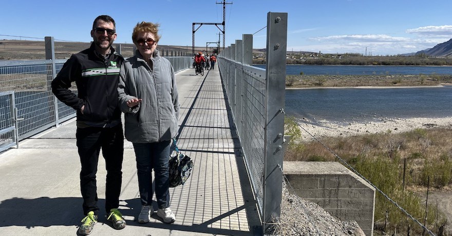
Washington is also starting to experience this phenomenon with the refurbished 3,000-foot Beverly Bridge. In the weeks leading up to the April 8, 2022, grand opening of the former railroad bridge along the Palouse to Cascades State Park Trail that was refitted with new decking, railings and viewing platforms, and now allows trail users to cross the Columbia River, Palouse to Cascades Trail Coalition Chair Fred Wert said people were emailing from out of state to learn more about the state’s longest trail.
“They’re planning their trips around the bridge, and not just in state, but out of state, which is really wonderful to see,” Wert said.
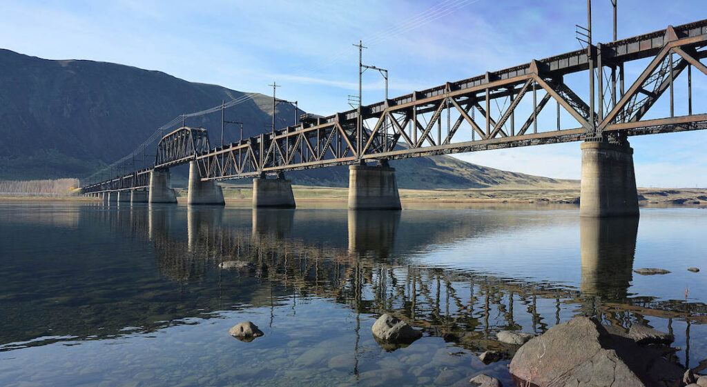
In previous years, most trail-newcomer interest was centered around one particular question: How do you cross the Columbia? Since 1980, the corridor that had crossed it as a host to transcontinental rail lines had laid disused. The answers, Wert said, were complicated at best. You either needed to bring a support vehicle on your trip or bike about 125 miles out of the way to get across the water on a pedestrian bridge and link back up with the 285-mile trail. Or you could try calling a nearby grocery store and hope that someone there would ferry you and your bike across the nearby Interstate 90 freeway bridge up in Vantage.
“It’s been a significant gap, just because there’s no viable detour at all,” Wert said.
The completion of the $5.5-million retrofitting of the Beverly Bridge has transformed the tourism potential of the trail as a cross-state corridor. The Columbia River used to cleave the trail into two parts. West of the Columbia River, it totals 111 miles—mostly compacted gravel, but also a stretch of sand—that cyclists, runners, walkers and horseback riders can share. It begins in the west at the foothills of the Cascades, about 35 miles from downtown Seattle, and shadows the path of I-90 toward the Columbia River.
In 2020, the Washington State Parks and Recreation Commission, which maintains about 250 miles of the trail, opened another key crossing along the route, the Renslow Trestle, which allows trail users to safely cross over I-90 just east of Kittitas. Additional trestles allow trail users to cross numerous canyons and take in sweeping views along the way to Beverly, where the trail used to end for so many.
“Before, you would come from the Seattle area, and you stopped at the Columbia River,” Wert said. “There’s no real way to get across unless you had a support vehicle.”
Now, the more undeveloped, eastern portion of the trail opens up for those who began in the west. The trail runs east to the Idaho border, where the rail line is private property. Because there are only a few towns with water available, it is largely a self-supported challenge—the kind that draws experienced hikers and bikers from across the country.
“I think many people will just be in awe, and I think one of the coolest things is that not often do they get to go on a railroad bridge,” Wert said. “So, I think it’ll be just an experience in itself as people come to visit and enjoy it.”
This article was originally published as the Cover Story in the Spring/Summer 2022 of Rails to Trails magazine. It has been reposted here in an edited format. Subscribe to read more articles about remarkable rail-trails and trail-networks while also supporting our work.

Donate
Everyone deserves access to safe ways to walk, bike, and be active outdoors.