Top 10 Trails in Texas
With mild temperatures much of the year (those long, hot summers aside) and relatively flat topography across much of the state, Texas can be a great place to ride, walk or roll along trails. Trails and trail networks are blooming around the Lone Star State like bluebonnets in the Spring—from urban ones in the Dallas-Fort Worth, Houston, San Antonio, Austin and Brownsville-Harlingen metros, to rural ones like the Northeast Texas Trail.
Here are a few of our favorite trails in Texas.
Trinity Trails (Fort Worth)
County: Tarrant
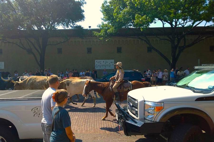
Sporting views ranging from flowers to rivers to the downtown skyline, the extensive 100-ish-mile Trinity Trails provide an urban oasis meandering through many different neighborhoods all over “Cowtown.” Popular highlights include cattle in Fort Worth’s historic Stockyards and concertgoers floating in front of the Panther Island Pavilion. Trail users might enjoy exploring different branches of the trail as they go, or tackling different sections on multiple trips.
Terry Hershey Park Hike & Bike Trail
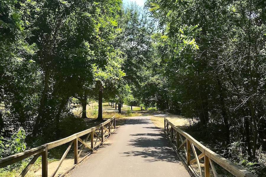
County: Harris
The most popular Texas Trail based on TrailLink user reviews, the Terry Hershey Park Hike & Bike Trail in West Houston runs for nearly 11 miles from Loop 8 to George Bush Park, where it connects with the top-rated George Bush Park Hike and Bike Trail. Well shaded (critical during hotter Texas months) and built along Buffalo Bayou, the Terry Hershey provides a transportation corridor and community connection—in addition to verdant scenery—as it passes through various neighborhoods, including Memorial.
Lake Mineral Wells State Trailway
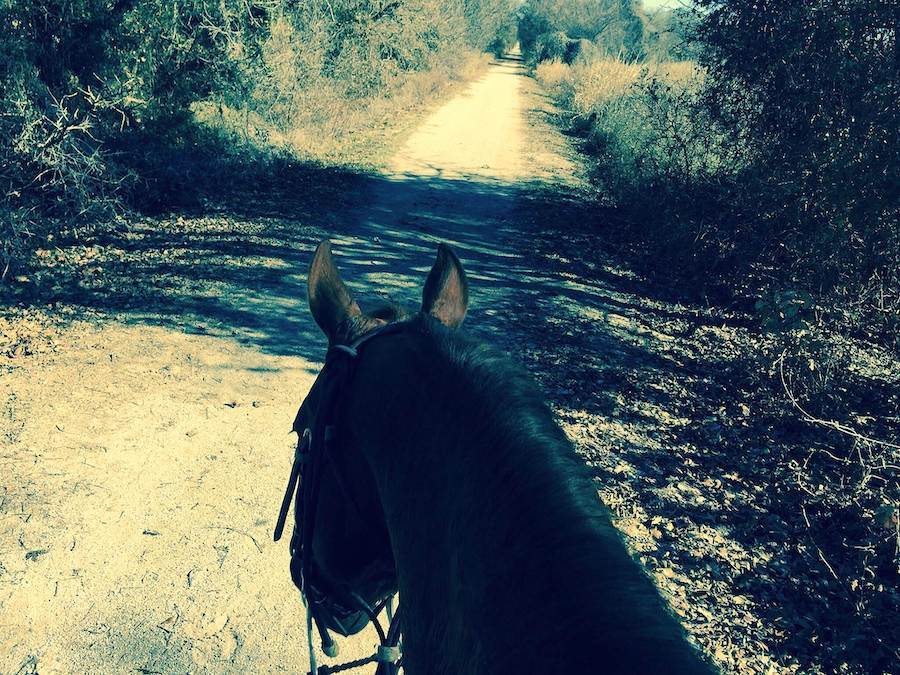
Counties: Palo Pinto, Parker
This mostly rural 20-mile rail-trail running east out of Mineral Wells toward Weatherford is like a Texas time travelin’ trip back to another era, where you might be more likely to spot a cottontail, cow or coyote than another human being. The trail passes through a state park of the same name, offering camping, hiking, rock climbing and water-based activities. Despite its rural setting, the eastern trailhead is only 40 minutes by car from downtown Fort Worth. Users who left reviews of this trail on TrailLink adore it; it gets five stars.
San Antonio River Walk Hike & Bike Path
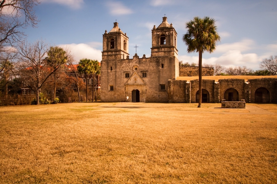
County: Bexar
The 30-mile San Antonio River Walk Hike & Bike Trail extends out to the north and south from the world-renowned San Antonio River Walk. The Hike & Bike Trail continues along the river on either end, fanning out through lush parks, city neighborhoods, hip entertainment and arts venues like the Pearl Brewery and Blue Star Arts Complex, and past museums and open-air restaurants. At its southern end, the Hike & Bike trail reaches the San Antonio Missions National Historical Park.
The trail—which often runs on both the east and west sides of the river—also provides a connection to 10 miles of trails linking Southside San Antonio with the West Side via the San Pedro Creek and Apache Creek greenways.
Chaparral Rail Trail
Counties: Collin, Delta, Fannin, Hunt
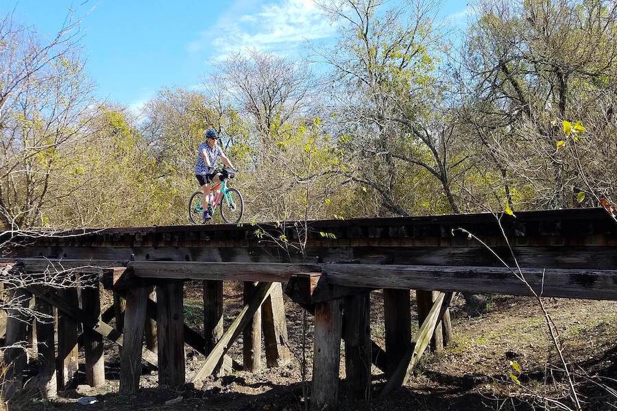
Beginning on the northeastern outskirts of the Dallas-Fort Worth Metroplex, the 35-mile Chapparal Rail-Trail is the most developed section of what will ultimately be a 130-mile rail-trail passing through small towns all the way to the Texas-Arkansas border: the Northeast Texas Trail. The Chapparal Rail-Trail features scenic, rustic train bridges and a rare glimpse into this rural section of Texas. Using Amtrak’s Eagle line, cyclists can take their bike on board from Dallas-Fort Worth (or Austin, San Antonio, El Paso—as far as Los Angeles or Chicago!) to Texarkana and ride the whole NETT back toward Dallas.
MAGAZINE FEATURE: Northeast Texas Trail: Stewards of Opportunity
Ann and Roy Butler Hike and Bike Trail
County: Travis
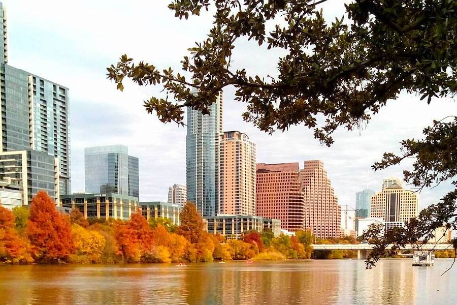
Many Austinites don’t know the official name of this 14.5-mile trail, chosen to honor a former mayor and his wife—they just know it as the “Lady Bird Lake” (or, if they’re Old School Austin, “Town Lake”) hike and bike trail. Whatever they call it, this popular urban gem loops around both sides of the lake (which is actually a section of dammed river), affording views of the city’s ever-expanding skyline and connecting to the city’s thriving Downtown as well as the beloved public, spring-fed Barton Springs Pool (in Zilker Park). The leafy trail twice crosses the Congress Avenue Bridge, home to the continent’s largest urban bat population; crowds gather at dusk from Spring to Fall to watch hordes of nocturnal bats emerge in a massive cloud. The trail connects to several other trails: the Barton Creek Greenbelt, home to secluded swimming holes and hiking trails; the Shoal Creek Trail; and the Johnson Creek Hike and Bike Trail.
Historic Battlefield Trail

County: Cameron
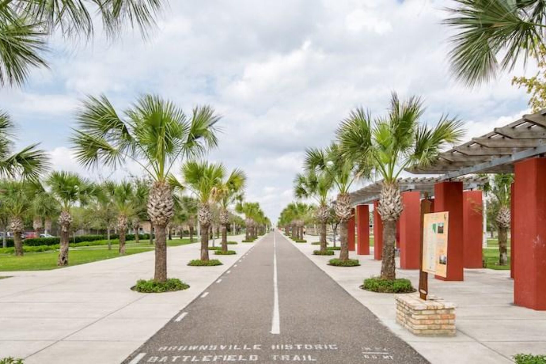
For 10 miles through the Lower Rio Grande Valley, the Historic Battlefield Trail encapsulates the history of its storied region, from the Mexican-American War battlefield flanking its northern end, to the Spanish-architecture-filled downtown at its southern terminus in Brownsville. From the north, trail users will wind their way south through Palo Alto Battlefield National Historic Park; after continuing through a linear park featuring an art museum and preserved train cars, the trail terminates in the center of old Brownsville, where it connects to one portion of Great Texas Coastal Birding Trail (or, one could continue biking into Mexico).
The 10-mile Historic Battlefield Trail is a key piece of the developing Caracara Trails network, a 428-mile system of trails designed to support and promote healthy lifestyles, active transportation and outdoor tourism across the Lower Rio Grande Valley. The border region, rich in Mexican-American culture and world renowned nature and wildlife, is popular with visitors, including “Winter Texan” retirees and birdwatchers drawn to the avian migratory zone.

Brays Bayou Greenway
County: Harris
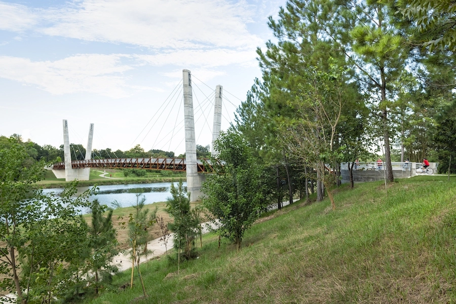
This being Texas, one “might could” call the 34-mile Brays Bayou Trail the “Football Trail” given that it passes within 1 mile of two active stadiums that have hosted Super Bowls (NRG Stadium and Rice Stadium), as well as the historic Astrodome and University of Houston’s field. But the Brays isn’t known for football; it’s part of a planned, 150-mile network of trails around Houston called Bayou Greenways 2020 that take advantage of the ubiquitous waterways that give the Bayou City its nickname. The Brays Bayou Greenway begins in the west/southwest part of the city (just inside Loop 8) and passes by a number of prominent destinations—including Houston’s famed Medical Center, vast Hermann Park, the Zoo and the museum district—before terminating almost as far east as the refineries and Ship Channel. Along the way, trail users can connect to Downtown and the East End via the Columbia Tap Rail-Trail.
Campion Trail (DFW/Irving)
County: Dallas
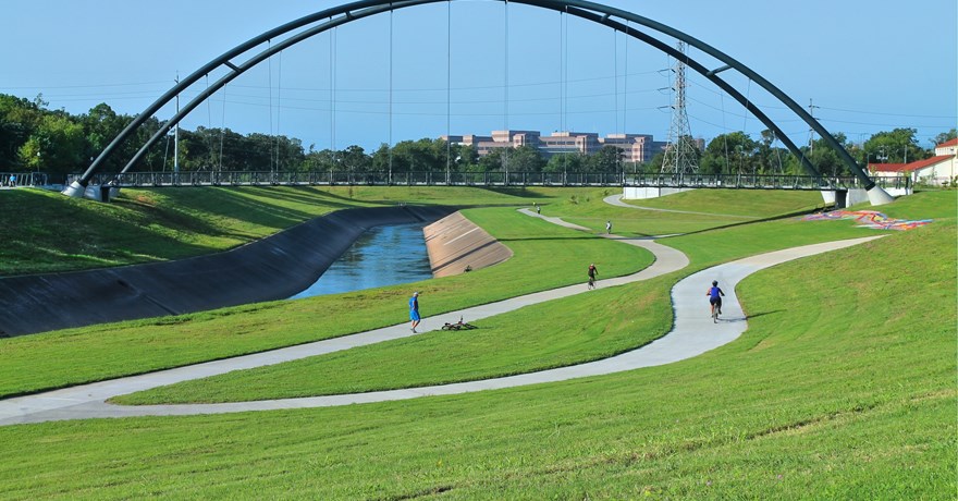
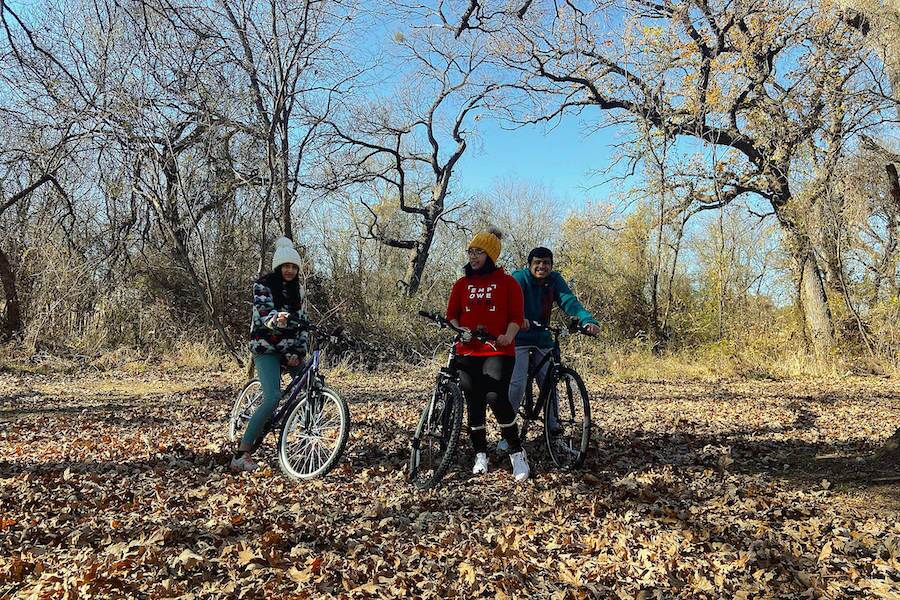
The Campion Trail’s two segments run mostly north-south for about 17 miles through Irving and other suburbs just outside of Dallas city limits, largely paralleling several forks of the Trinity River. The trails connect a number of communities and offer greenery and access to several of parks. The southern segment connects to Grand Prairie’s Lone Star Trail, and Lone Star Park, which features a concert venue, race track and minor league baseball stadium. Plans aim to connect the two trails to a network traversing Arlington, Dallas and even Fort Worth.
Salado Creek Greenway
County: Bexar
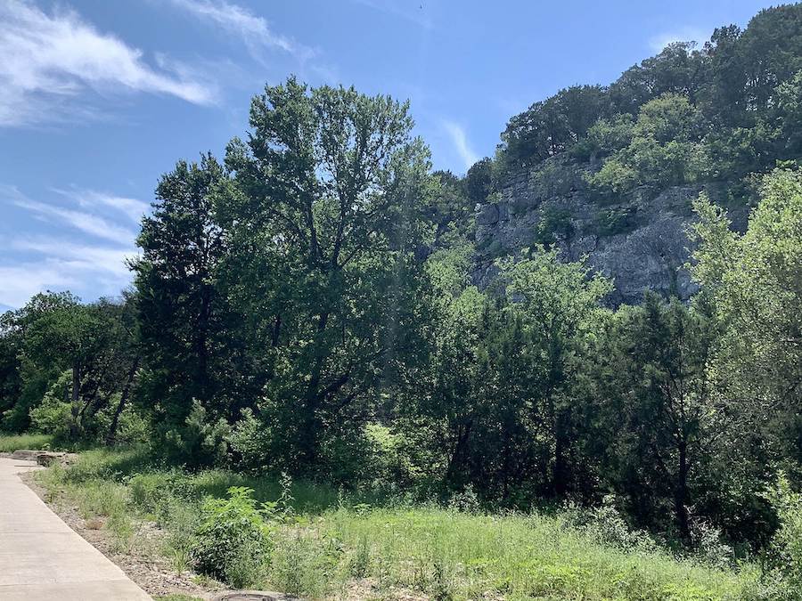
One of the most popular Texas trails on TrailLink and sporting a 5-star rating, the Salado Creek Greenway spans many neighborhoods and community parks, providing a natural respite amidst San Antonio’s north, northeast and east sides. It is currently divided into two segments, with plans to connect and extend them as part of a network of city trails partially encircling and running through America’s seventh-most-populous city. At the end of the greenway’s scenic northern segment—which includes forests, bluffs and city views (as well as the airport)—the city plans to close the short gap to the popular Leon Creek Greenway.
Honorable Mentions
North Texas really shines in terms of great trails; it had more than we could fit on this list. In the Dallas-Fort Worth Metroplex, the 11.2-mile Cotton Belt Trail currently offers views of bucolic streams as it connects suburbs between Fort Worth and DFW International Airport. But it is also the “spine” for a planned extension of a larger 55-mile trail network that will include a rail-with-trail along a forthcoming commuter line.
Recent expansions have completed the A-train Rail Trail, a 19-mile rail-with-trail that includes the Denton Branch Rail Trail and Lewisville Hike and Bike Trails. And farther out, near the Oklahoma border, the Wichita River and Holliday Creek Trails wend along the Big Wichita River for nearly 15 miles, linking a number of Wichita Falls parks.
Special acknowledgments: Laura Stark, lead writer and editor for RTC; Philip Hiatt Haigh, the LOOP Dallas; John Peterek, City of San Antonio; Robin Stallings, BikeTexas
When you subscribe to Rails to Trails magazine, you’ll have access to many other features like this one. Our magazine is a premium of Rails to Trails membership. Join today to start receiving the magazine!

Donate
Everyone deserves access to safe ways to walk, bike, and be active outdoors.
