Top 10 Trails in Washington, DC

Check out some of our favorite trails in Washington, DC, below.
It’s to be expected that our nation’s capital would contain some of the most renowned landmarks and green spaces in America—connecting us to our history and heritage, and celebrating the many people and diverse cultures that make up our country. But D.C. has a lot of treasures to discover—not least of which are its rail-trails and multiuse pathways, which provide linkages, large and small, to many of the communities, rich recreational opportunities and iconic places and spaces D.C. is known for.
What’s more: D.C.’s trails are playing a key role in the Capital Trails Coalition, which is in the process of connecting the entire metropolitan region with an equitably distributed 800-mile trail network!
Metropolitan Branch Trail

Eventually stretching for 8 miles between Washington, D.C.’s Union Station and Silver Spring, Maryland, the Metropolitan “Met” Branch Trail (MBT) has already become a central pathway for the capital, serving thousands of commuters and recreational trail users, and connecting some of the city’s most historic and burgeoning neighborhoods—including NoMa, Eckington, Edgewood and Brookland. Following the Metropolitan Branch rail line of the former Baltimore and Ohio Railroad, the busy rail-with-trail is adjacent to four active rail lines, including: Metro’s Red Line, MARC commuter service, CSX and Amtrak.
Highlights include vibrant revolving murals, the recently completed Alethia Tanner Park, and The Arts Walk with galleries, studios, eateries and shopping. Plans to further develop the trail include creating a connection to the Capital Crescent Trail in Silver Spring.
RELATED: Heartbeat of the Capital: How the Met Branch Trail Is Creating Common Threads in DC
Rock Creek Park Trails
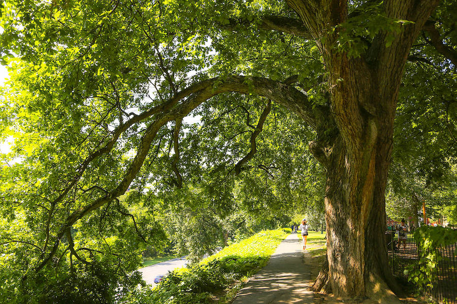
The oldest urban national park in America, established in 1890, Rock Creek Park offers more than 32 miles of hiking and bicycling trails weaving through 1,700+ acres of green space in northwest D.C. Among the numerous trails is an 8.5-mile paved pathway that runs parallel to Beach Drive and Oregon Avenue—also loosely following Rock Creek—in two main segments between I-66 at Peters Point in D.C. and the Maryland border.
Picnicking, boating, horseback riding, tennis, golfing, historical exploration and connecting to nature are just some of the activities offered in the park. Three visitor centers serve as anchors, including a Nature Center and Planetarium, a mill dating back to the 1700s and the Old Stone House in Georgetown, the oldest structure on its original foundation in the city. The Rock Creek Park Trails are also part of the developing 3,700-mile Great American Rail-Trail™, which will one day connect Washington, D.C., and Washington State.
Closure Notice: The District Department of Transportation and the National Park Service are working on improvements to the southern segment of the paved trail, with a grand opening planned for winter 2024. Sections of the trail may be subject to closures and/or detours. Please check the official project site for updates.
National Mall Trails
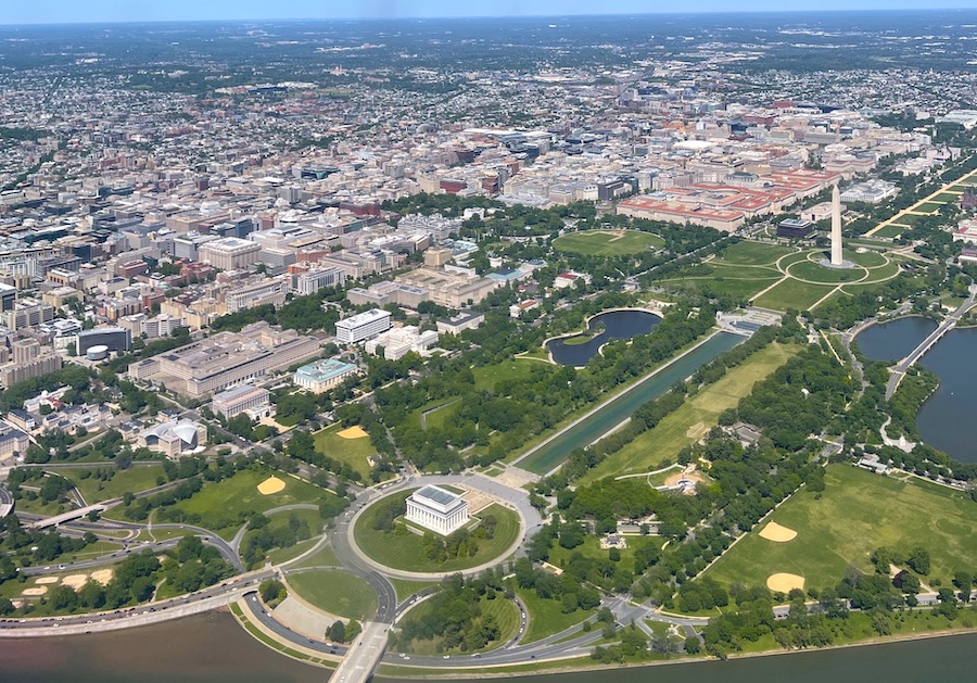
Needing little by the way of an introduction, the National Mall and Memorial Parks is one of the most visited parks in the world, featuring more than 100 monuments and memorials that honor the many people who have lived and served within the lands that now make up the United States.
The tree-lined mall comprises a series of largely pedestrian-oriented interlinked pathways on a grid about 2 miles long and 0.3 mile wide and encompassing more than 1,000 acres. The walkways connect iconic sites such as the Washington, Lincoln and Martin Luther King, Jr. memorials, the White House and the U.S. Capitol Building to many nationally renowned museums, including the National Gallery of Art and the famous Smithsonian Institution complex. In the spring, the National Cherry Blossom Festival sees millions of people flock to the Tidal Basin—and year-round, residents and visitors enjoy pick-up sports and cultural activities throughout the space known as “America’s Front Yard.”
Appropriately, the National Mall Trails also serve as the easternmost section of the 3,700-mile Great American Rail-Trail.
Anacostia River Trail
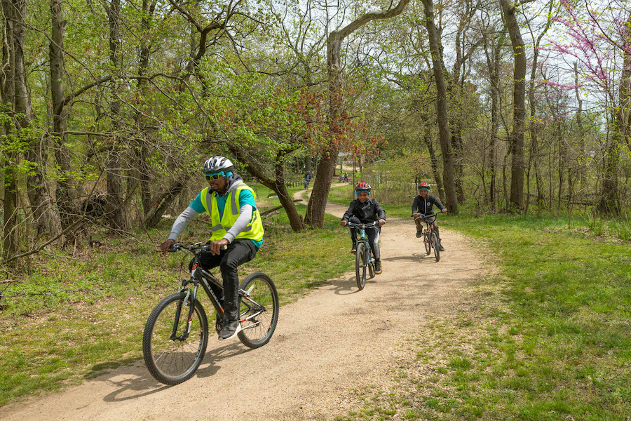
This eventual 20-mile trail, which currently spans about 12 miles on both sides of the Anacostia River, will ultimately connect 16 neighborhoods in the D.C. area. The paved trail occupies riverside wooded natural areas, marshland, urban development and parkland.
Along the Anacostia Riverfront, you’ll find a multitude of recreational assets, including community centers, playgrounds, a roller skating pavilion and sports fields. The trail already boasts links to major destinations in the city such as Nationals Park, Diamond Teague Park, historic Navy Yard and the Kenilworth Aquatic Gardens, and will eventually connect to the Tidal Basin and the National Mall. The river trail provides a further expanded experience as part of a trail system with connections to the Northwest Branch Trail and the Northeast Branch Trail in Maryland.

Klingle Valley Trail
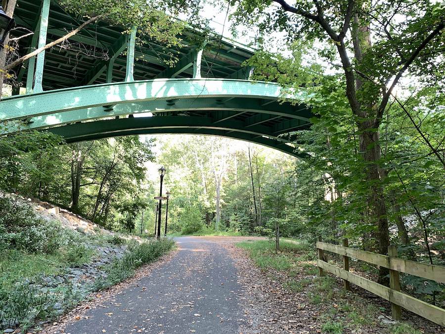
Short but sweet is how we’d describe this 0.7-mile gem in a treelined residential area of northwest D.C. Opened in 2017, the paved trail bisects the Klingle Valley, crossing Rock Creek Park between Cortland Place and Porter Street on a path just north of the National Zoo.
The trail serves three communities—including Cleveland Park, Woodley Park and Mount Pleasant—as it rolls along a former roadway for which it is named, which suffered severe damage by floods in 1991. The trail connects to the Tregaron Conservancy—an historic woodland park with its own network of trails, gardens and other natural space to escape from urban life.
Of note: The trail project included important restoration features for the long-neglected area of Klingle Creek.
Chesapeake & Ohio Canal National Historical Park
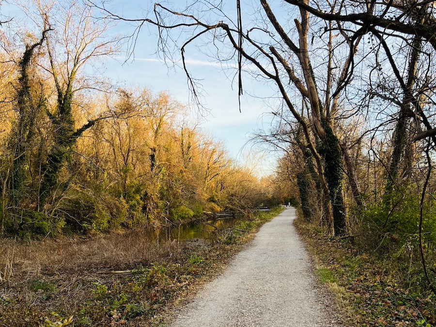
With a history stretching back to George Washington, the 184.5-mile Chesapeake & Ohio Canal National Historical Park (C&O Canal Towpath)—which begins near the National Mall (paralleling the Capital Crescent Trail for a few miles) and stretches to Cumberland, Maryland—was once an important commercial transportation corridor for the towns along its route. Today, it continues its legacy as an economically important landscape for active transportation, recreation and outdoor tourism. Many original features remain from its days of the Canal Era, including locks, lock houses, aqueducts and other relics. The canal also played an important role in the American Civil War, serving as a dividing line between the North and South.
In Cumberland, the trail meets the Great Allegheny Passage (gaptrail.org) to help form a continuous 334.5-mile route between Pittsburgh and D.C., an iconic trip that draws people from around the world. The trail is also a host for the 1,300-mile September 11th National Memorial Trail and the 3,700-mile Great American Rail-Trail.
Capital Crescent Trail
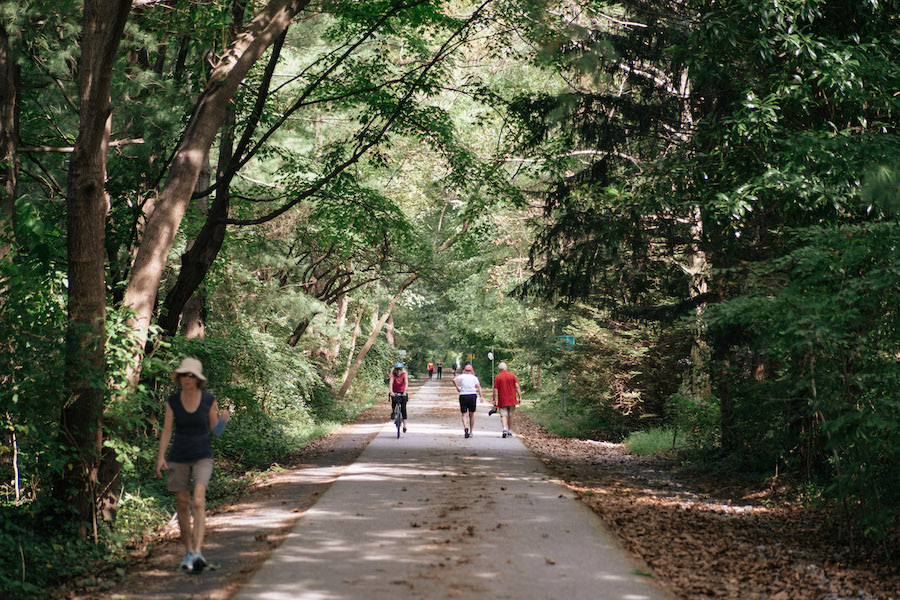
Serving more than 1 million people per year, the Capital Crescent Trail is a premier D.C. recreation and commuting corridor between Silver Spring, Maryland, and historic Georgetown in D.C. that travels a crescent-shaped route featuring waterside views, wildlife, parkland, and major cultural and historical sites. In Georgetown and in west Silver Spring, the trail connects to Rock Creek Park—the largest urban national park in the country with dozens of additional miles of hiking and biking trails. In D.C., the trail—which travels along the Potomac River and the C&O Canal Towpath for a ways—takes you past major attractions such as the National Zoo and the Kennedy Center.
With a history stretching back to the 1980s, the trail was created through the energy and advocacy of dozens of organizations. Today, it serves as a gateway trail in D.C. to the 3,700-mile Great American Rail-Trail.
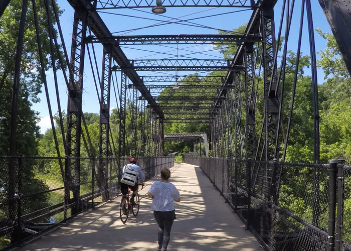
Oxon Run Trail
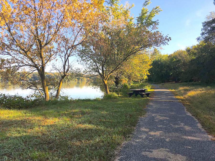
Called a “great trail and a best-kept secret” by one TrailLink.com™ reviewer for its convenience and scenery, the Oxon Run Trail offers a 3.4-mile jaunt along its namesake tributary (of the Potomac River) in Oxon Run National Parkway on two disconnected sections in southeast D.C. and in Prince George’s County, Maryland.
The trail exists in an area served by few trails, making it an important asset for outdoor physical activity and connecting to nature. It was recently rehabilitated with new asphalt on both sides of the tributary and upgraded with wider paths and better lighting.
Future plans include expanding the trail an additional 4.8 miles—and connecting it with the planned Oxon Cove Hiker-Biker Trail and the South Capitol Trail.
Note: Near where the trail begins at its south end at Oxon Cove Park & Oxon Hill Park, and heading north, trail users will find a brief section with a steep downward grade.
Fort Circle Park Hiker-Biker Trail
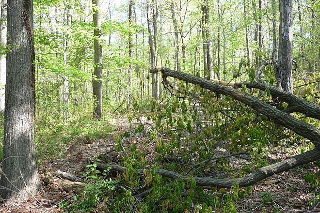
This understated but historically significant 7-mile trail runs through a forested area between Fort Mahan and Fort Stanton, linking dozens of Civil War-era forts (most of which are now national parks).
A large portion of the trail traverses Fort Dupont Park—a 376-acre wooded green space that was once home to an earthen fort erected as part of the Eastern Branch Line Defenses in the early 1860s. Today, activities of all kinds—from nature walks and picnics to concerts and Civil War programs—can be enjoyed there. Although the fort never saw battle, it served as a lifeline for enslaved people who found safety there before joining Union efforts in D.C. The fort is gone, but its earthworks can still be seen.
Note: The pathway can feel very rural, but note that the route travels through several busy road crossings. The pathway can also get overgrown in the summer, and muddy after rain. Hiking or mountain biking are recommended.
Marvin Gaye Trail
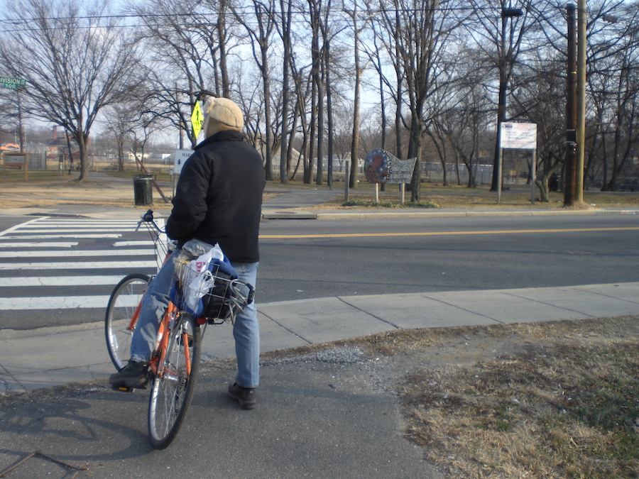
Named after the famous musician who was born and raised in D.C., the Marvin Gaye Trail is a nearly 2-mile pathway running from Minnesota Avenue (near the Minnesota Avenue Metro Station) to 61st Street, NE (near the Capitol Heights Metro Station). The route—traversing Marvin Gaye Park, D.C.’s longest municipal park—loosely parallels Watts Branch Stream as it makes its way through the Deanwood, Burville, Lincoln Heights and Hillbrook neighborhoods. Of note, the trail travels past two elementary schools and a high school, providing critical safe access to numerous recreational opportunities for students—as well as shopping and restaurant access.
On its east end is Marvin Gaye Recreation Center, which offers a baseball field, basketball court and playground. Heading west, the trail and revitalized green space provide vital opportunities for people to get outside, picnic, enjoy gardens and performances and connect with nature. A colorful mosaic with Marvin Gaye’s image can be found at the entrance to Lady Bird Johnson Meadows, situated at the western end of the park.
Special acknowledgments: Liz Thorstensen, Kelly Pack
When you subscribe to Rails to Trails magazine, you’ll have access to many other features like this one. Our magazine is a premium of Rails to Trails membership. Join today to start receiving the magazine!

Donate
Everyone deserves access to safe ways to walk, bike, and be active outdoors.
