New York’s Ashokan Rail Trail
Trail of the Month: December 2019
“We find ourselves here today on a rail-trail that is national park-worthy, world-class really.”
—Michael Hein, former Ulster County Executive
On its opening weekend, in the throes of peak leaf season, the stewards of New York’s Ashokan Rail Trail assembled at the Woodstock Dike Trailhead because they rightly suspected that trail users would overflow the first of the three parking lots to open. The 11.5-mile path was offering, for the first time in a century, public access to the north rim of the scenic, invaluable Ashokan Reservoir, which provides New York City with 40% of its drinking water. All weekend long, cars and vans full of people psyched to explore the trail and see some foliage arrived from the Hudson Valley, New York City, New Jersey and Connecticut.
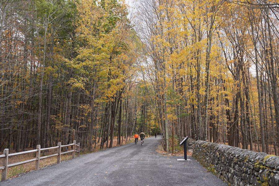
“The response has been overwhelmingly positive,” said Chris White, deputy director of planning for Ulster County. “It’s a magnificent backdrop for a trail, and it’s a beautifully built trail.”
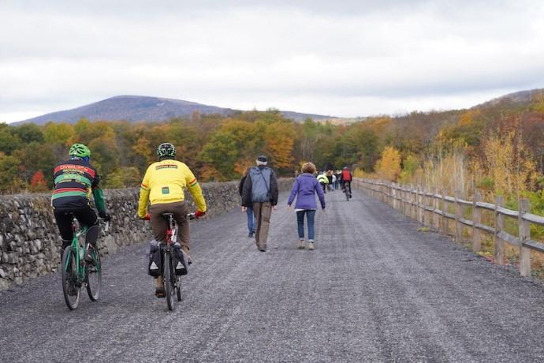
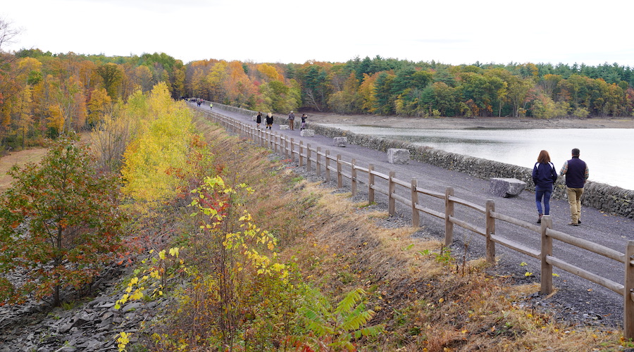
Though the trail opened in autumn, the ART, as it’s colloquially called, offers year-round views. The area abounds with red maples, birch and eastern white pine trees, and features protected wetlands and a 525-foot boardwalk. The Catskill Mountains, once an inspiration to famed Hudson River School artists and conservationists like Thomas Cole and Asher Durand, beckon from the ART. The trail crosses the 2,850-foot long, 60-foot tall Glenford Dike, an engineering marvel completed in 1912 to allow passage of trains bringing supplies to and tourists from New York City via the former Ulster and Delaware Railroad. And, scenery-wise, the nearly 123-billion-gallon reservoir is no slouch either.
A Partnership Built on Water
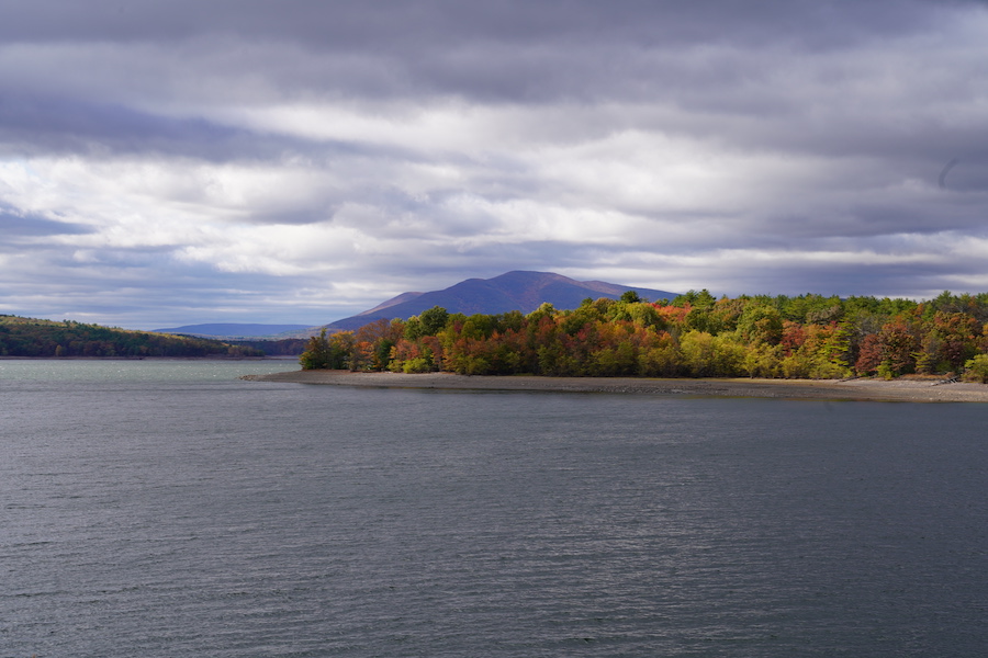
Like many rail-trails, the ART experienced a bit of a rocky beginning. The New York City Department of Environmental Protection (DEP), which oversees the city’s enormous drinking water supply, had for decades blocked the Ashokan Reservoir off from the public in an effort to mitigate potential harm to the reservoir. But DEP grew to support the project and ART became an ideal outdoor public asset founded upon the strong programs and partnerships that the agency forged to keep the water protected.
DEP spokesman Adam Bosch said that, during the department’s history, the goal of protecting the 1.2-million-acre watershed from which the city draws its drinking water has led to the development of forestry and stream programs, partnerships with farmers and upgrades of private septic systems—all efforts to protect the water, 90% of which reaches the city’s 9.6 million customers in an unfiltered state.
One of the department’s largest programs, in both expense and acreage, is its land acquisition program. To date, DEP owns about 150,000 acres of forest located mostly in the Catskills. The watershed area is home to about 25,000 people, and Bosch said many of those residents asked the department to open up some of those lands for public use. Their voices were heard, he said.
“We have a very intensive water-quality monitoring program,” Bosch said. “The data showed there was really no harm in doing that. Over time, we’ve opened about 138,000 acres of land to what we call low-impact recreation. Things like hiking, fishing, hunting, trapping.”
Building off those developments, trail developers asked if they could create, at first, primitive trails that led hikers to scenic mountainscape and ridgeline vistas on city property.
“We tried it, and it worked out great,” Bosch said “And we tried it again. It worked out great, and we’ve kept doing it, and we’ve seen no impact on water quality.”
The Ashokan Rail Trail is the 16th trail that the DEP has opened along land that supplies New York City’s drinking water supply.
The Ashokan, Bosch said, is unique. The reservoir was built in the early 1900s as an answer to New York City’s massive population boom (from about 300,000 residents in 1842 to some 3.5 million by 1900). To create the reservoir, state lawmakers passed legislation allowing the city to use eminent domain to acquire land in the valley that would be flooded. Twelve communities were either relocated or wiped off the map, as was a 13-mile stretch of the Ulster and Delaware Railroad Line that found a new home on the northern rim of the Ashokan Reservoir.
Over several decades, as with many rail lines that have been converted to trail, the Ulster and Delaware’s usage decreased sharply. In the late 1970s, after passing through several hands, Ulster County ended up in possession of the rail easement. In the early 2010s, then-Ulster County Executive Michael Hein led an effort to develop the rail line into rail-trail. Bosch said the DEP would support county decisions, as long as the pathway was designated for either rail-trail or railway usage. The Catskills area now offers both.
The ART is “a story of collaboration” according to White. The $16.5 million trail project was funded through a combination of county, state and city contributions. About 30 government resolutions later, it’s here to stay.
The Catskill Mountain Railroad currently operates a for-profit touring line out of Kingston, Ulster County’s seat, which runs northwest on the former Ulster and Delaware line to Stoney Hollow, about 2 miles from the ART’s eastern trailhead. The group had wanted the rail line to remain dedicated to rail, but have recently released a business plan featuring an extended operating line to the ART trailhead, according to Kingston’s newspaper, the Daily Freeman.
Dazzling Debut
At the Oct. 18 ART opening, Hein said the trail managed to exceed his lofty expectations.
“We find ourselves here today on a rail-trail that is national park-worthy, world-class really, just like we envisioned it could be,” Hein said, according to the Daily Freeman.
The trail’s crushed-stone trail surface, measuring 10 to 12 feet in width at various points, is ADA compliant, and features no crossing streets. It’s so compacted that thin-tired bikes can safely travel on it, White said.
“This trail is available for anyone of any age—toddlers, triathletes, the elderly,” White said.
Interpretive signs provide not only a history of the area, but also explain the vast process of providing New York City with its water.
“It’s so important that people today know where their drinking water comes from, and the work that’s done to protect that water and test that water and keep it clean and wholesome,” Bosch said. “The more often we can get people from the city and other communities that we serve to actually see it, the more they will appreciate it, the more they won’t take it for granted.”
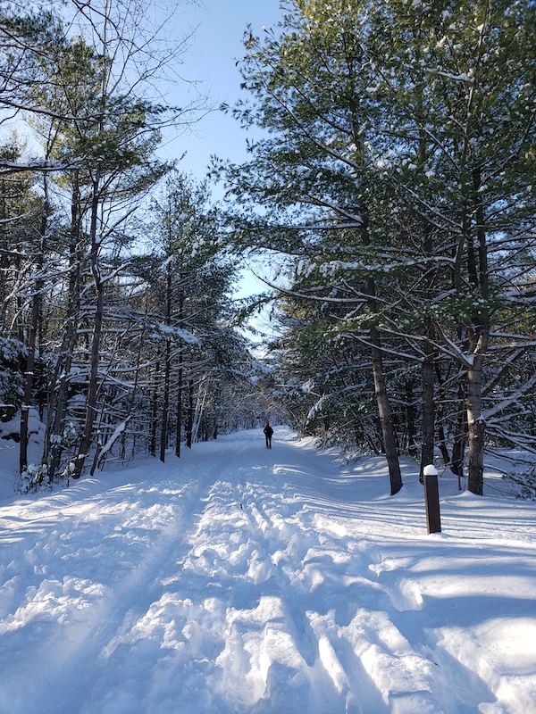
This week, about a foot of snow fell in the Catskills, and cross-country skiers and fat-tire bike riders took to the unplowed trail, which is open year-round.
Kevin Smith, board chair of the ART-supporting Woodstock Land Conservancy, was itching to get on the trail on Dec. 3, the first sunny day since the snowstorm hit. He, Bosch and White planned to ride bikes on the trail next weekend. They might have to snowshoe instead.
“These are good problems to have,” Smith said.
The land conservancy partnered with the New York-New Jersey Trail Conference, Ulster County and DEP to establish the trail’s steward program, and Smith said over 40 people came to the initial training in early October.
As the ART neared its opening date, Smith was anticipating a big crowd. He’d heard that local bike shops were tuning up bikes that looked like they’d lived long stretches of their lives in cellars or garages. Still, when the opening day arrived, he said he and other volunteers were taken by surprise by “the pent-up excitement and enthusiasm for the trail.”
Smith described opening weekend parking duty along the lines of working an outdoor fair. He and other stewards chatted with the drivers, asked where they’re from, how they learned about the trail or said hi to familiar faces behind the wheel. Many of the visitors who came to walk part of the trail ventured to the Glenford Dike, moseyed along the structure, surveyed the stone wall that runs atop it and spoke to others who were doing the same. Smith said it reminded him of a European boulevard.
He paid particular interest to visits by families with young children. Many rural communities surrounding the Ashokan Reservoir are experiencing population aging and decline, as young people, like the water, move to the city.
“For us to see all these families, it’s fantastic,” Smith said. “It’s why we did this.”
Related Links
Trail Facts
Name: Ashokan Rail Trail
Used railroad corridor: Ulster and Delaware Railroad
Trail website: Ulster County’s Ashokan Rail Trail website
Length: 11.5 miles
County: Ulster
Start point/end point: From east to west, the Ashokan Rail Trail lies between Basin Road in West Hurley and Route 28A in Boiceville along the Ashokan Reservoir.
Surface type: Compacted crushed stone
Grade: Easy; the trail is ADA compliant.
Uses: Walking, bicycling, cross-country skiing, wheelchair accessible; motorized vehicles other than electric wheelchairs prohibited
Difficulty: Easy
Getting there: The easternmost trailhead lies about 7.5 miles northwest of Kingston, and 4 miles south of Woodstock. By train, the nearest Amtrak station is located across the Hudson River in Rhinecliff, New York, about 16 miles from the trailhead. The nearest international airports are the New York Stewart International Airport in New Windsor, New York (45 miles driving), Albany International Airport (67 miles), Bradley International Airport in Windsor Locks, Connecticut (92 miles), and LaGuardia International Airport in Queens, New York (106 miles).
Access and parking: The Ashokan Rail Trail offers three trailheads with parking:
- Woodstock Dike Trailhead located at 1285 NY 28 in West Hurley, which is 5.3 miles west of the NYS Thruway Exit 19 traffic circle and approximately 1,500 feet west of the Stewart’s Shop by Zena Road
- Ashokan Station Trailhead located at 3045 NY 28 in Shokan, which is 11.3 miles west of the NYS Thruway Exit 19 traffic circle across from Mountain Road
- Boiceville Bridge Trailhead located at 5080 Route 28A in Boiceville, which is off Route 28A and approximately 16.5 miles west of the NYS Thruway Exit 19 traffic circle (Cold Brook Road is directly across Route 28A from this entrance.)
To navigate the area with an interactive GIS map, and to see more photos, user reviews and ratings, plus loads of other trip-planning information, visit TrailLink.com, RTC’s free trail-finder website.
Rentals: Bicycle rentals are available from: Overlook Bicycles (93 Tinker St., Woodstock, NY; 845.679.2122); Woodstock Town Car (845.679.6656); and Bicycle Depot (15 Main St., New Paltz, NY; 845.255.3859). Additionally, Kingston Cyclery (1094 Morton Blvd., Kingston, NY; 845.382.2453) provides rentals during the summer season.

Donate
Everyone deserves access to safe ways to walk, bike, and be active outdoors.
