Five Rail-Trails for Marveling at National Monuments

There are countless special places in America, but only about 100 have been distinguished enough to be called national monuments. Granted protection by Congress or the president by way of the Antiquities Act, these emblems of our country’s landscape allow us—from generation to generation—to learn, discover and admire. Taking the form of statues, forests, canyons, ruins or reefs, it’s no wonder that people from all over come to visit these spectacular sites and act as their ambassadors.
Scattered throughout the U.S., many of them have or are near trails—lucky for trail lovers! Here’s a short list of five rail-trails at national monuments that’ll help you reach, explore and admire some of these incredible places.
1. Mill Valley/Sausalito Multiuse Pathway (California)
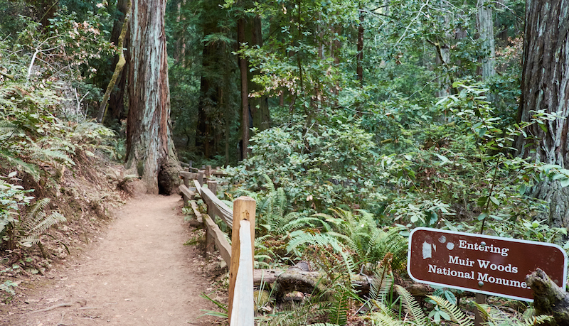
Though it’s a shorter rail-trail at just shy of 4 miles, the Mill Valley/Sausalito Multiuse Pathway is a great connector. Locally linking to the Charles F. McGlashan Pathway and its Marin County neighborhoods with amenities and important stops, the little trail is also a piece of a big project: the developing 500-mile San Francisco Bay Trail system. The pathway sits right near the water, presenting its users with access to Coyote Creek, Richardson Bay, marshland, wetland wildlife, the ferry to San Francisco—and a quick trip to Muir Woods National Monument.
Named after Sierra Club co-founder John Muir (also known as the “Father of Our National Park System”), Muir Woods is one of America’s most-visited national monuments. Encompassing more than 500 acres of pristine wilderness, the Muir Woods feature gorgeous old-growth coast redwood forests. The protected lands offer a home and shade to more than 50 bird species, steelhead fish and endangered salmon, bobcats, banana slugs and many more.
2. Wood River Trails (Idaho)
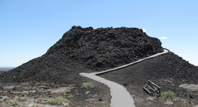
Commonly known to the locals as “the bike path,” the Wood River Trails create a paved, nearly 34-mile trail system that connects the Wood River Valley, Bellevue, Hailey, Ketchum and Sun Valley communities. The Wood River Trails system treats its users to spectacular views of grasslands, bridges, rivers and mountains, and accommodates walkers, skiers, cyclists and inline skaters. The system is also not too far—around 50 miles—from a monument with one far out name: Craters of the Moon.
The monument’s “weird and scenic landscape” looks like something from outer space, but its unique appearance is actually a product of what was happening deep down in the earth 15,000 to 2,000 years ago, which caused eight major eruption periods. The volcanic site has an ocean of lava flows, lava tubes (or cave areas), craters, the Great Rift and cinder cones to explore; two paths through the preserved lands are wheelchair accessible, and there is a designated camping area.
3. High Line (New York)

New York’s High Line is a can’t-miss way to experience the Big Apple from an elevated, 1.5-mile path. Offering locals and tourists alike with a rare view of the city’s skyline and the Hudson River, this public park connects neighborhoods in the lower west side of Manhattan and provides vibrant green space.
Truly a landmark project, the High Line is also within a short distance of a handful of iconic national monuments: the Statue of Liberty, Governors Island, Castle Clinton, African Burial Ground and more. Although each of these monuments are significant to American culture and history, Lady Liberty literally stands out with her 305-foot colossal form and torch lifted to represent “liberty enlightening the world.” A gift of friendship, she was dedicated in 1886 and officially designated as a national monument in 1924; today, in addition to attracting approximately 4 million visitors annually, she still serves as an everlasting symbol of freedom to the world.
4. McQueen’s Island Trail (Georgia)
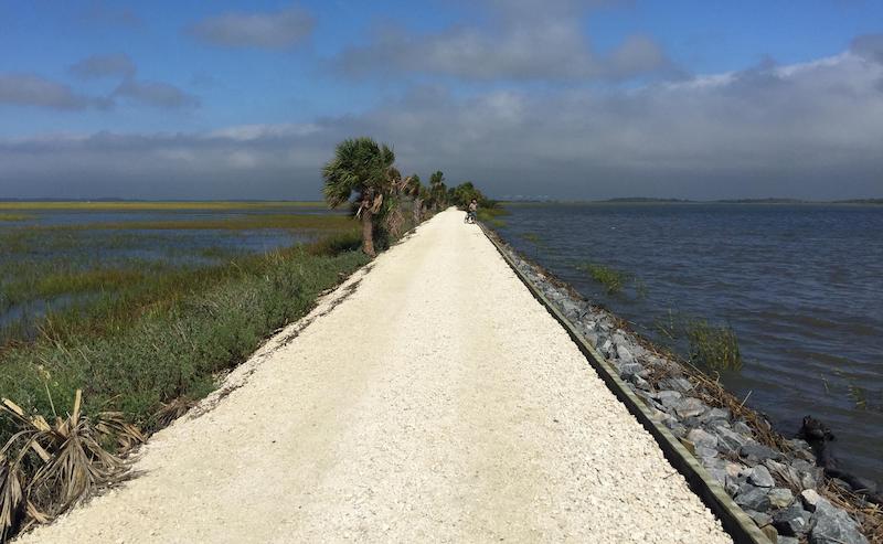
A spectacular southern stretch in Georgia, McQueen’s Island Trail is an approximately 6-mile route by the water and imbued with history. Starting in the Spanish moss-covered Savannah, this rail-trail follows the South Channel of the Savannah River and carries its users through saltwater marshes; along the way will be palms, turtles, a variety of coastal birds and even alligators. The popular tourist destination Tybee Island, home of Georgia’s oldest and tallest lighthouse, sits just east of the trail, and toward the west is the Fort Pulaski National Monument.
Named after Revolutionary War Hero Casimir Pulaski, Fort Pulaski received its national monument designation in 1924. Today, it is one of the best-preserved forts designed with Third System military architecture—which, when established in the 19th century, was a big breakthrough for shoreline defense. Despite its original intention to keep Georgia safe from foreign powers, Fort Pulaski wasn’t used in battle until the Civil War.
5. Casey Jones State Trail (Minnesota)
The Casey Jones State Trail is a multipart trail with an interesting multipart backstory. It was happily born in the 1960s when it became one of the first state trails authorized by Minnesota legislation, but its name honors a sad story from 60 years earlier, when railroad conductor Casey Jones’ train collided with another. Today, the rail-trail’s three sections travel through several beautiful landscapes—prairie, woodland ravines, farmland and small towns—as well as near many eye-catching sights: museums with railroad remains, lakes, wind turbines, parks and the Pipestone National Monument.
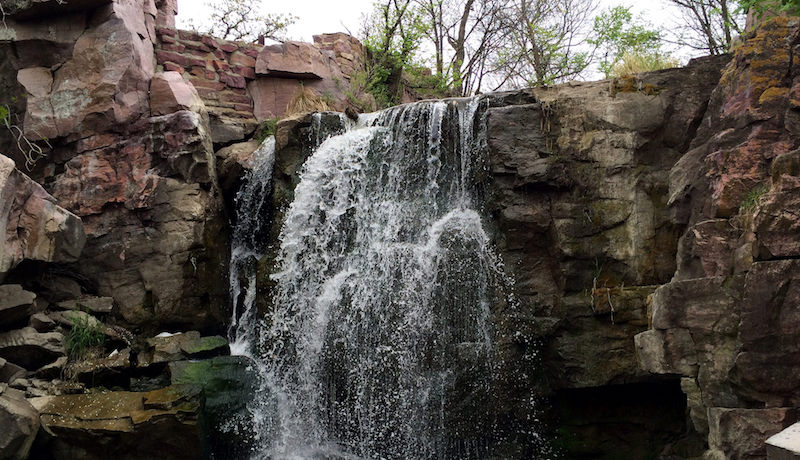
The Pipestone National Monument is a mere 1.5 miles from the Pipestone trailhead and was officially designated in 1937. Its unique formation was crafted from centuries of quarrying by Native Americans who carved ceremonial pipes out of the red rock for prayer. This religious ritual is still practiced by Native Americans today, and visitors are able watch live demonstrations at the Visitor Center during part of the year. The monument is also home to the breathtaking, 20-foot-tall Winnewissa Falls.

Donate
Everyone deserves access to safe ways to walk, bike, and be active outdoors.

