Arkansas’ Southwest Trail
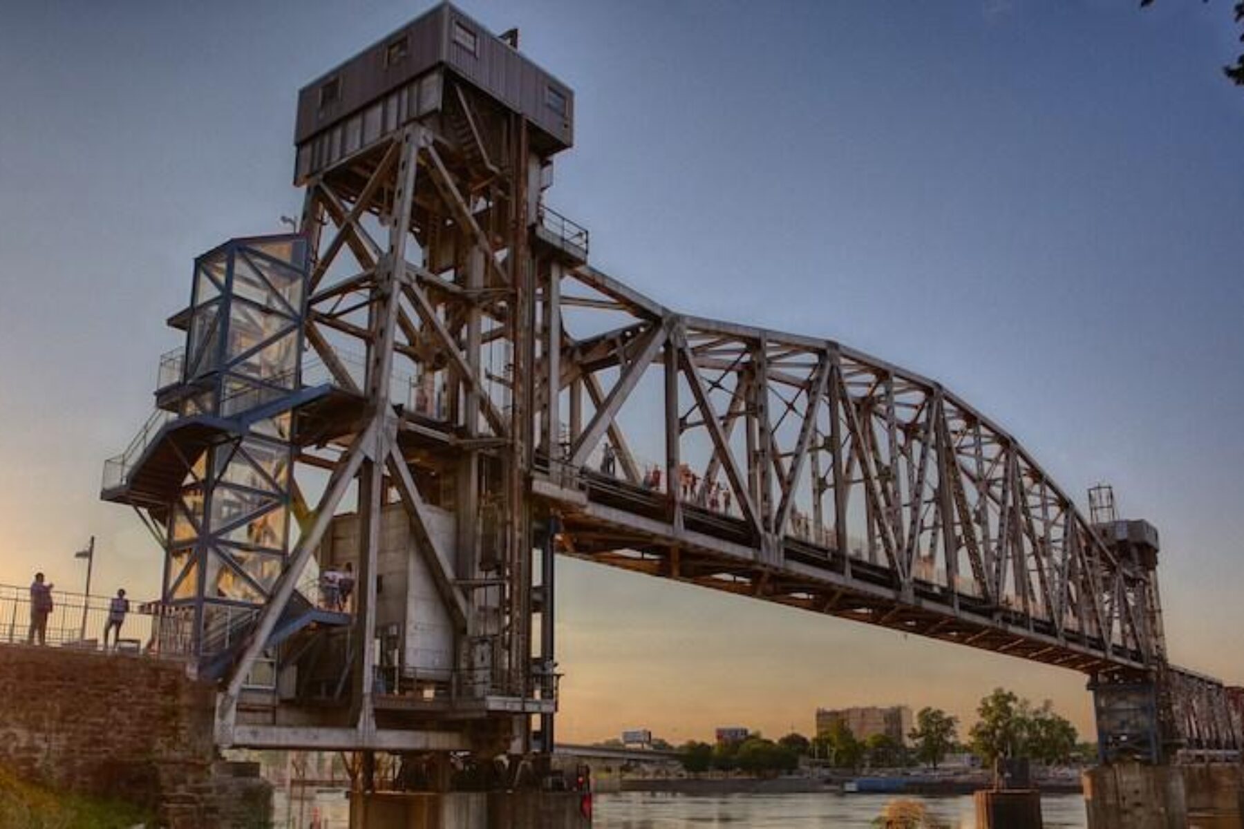
Trail of the Month: December 2018
“A 50- or 60-mile trail? That’s a national attraction.”
— Buddy Villines, Former Pulaski County Judge
Arkansas isn’t known for its rail-trails … yet. But after some recent success with paved corridors and unpaved, single-track paths, the Natural State’s newest rail-trail venture—the Southwest Trail—could bring both national attention and important local benefits.
Named after an early-19th-century migration path, the new incarnation of the trail will run along a disused Rock Island Railroad corridor through several counties, from Little Rock Central High School, site of an infamous desegregation fight and now a National Historic Site, to Hot Springs National Park.
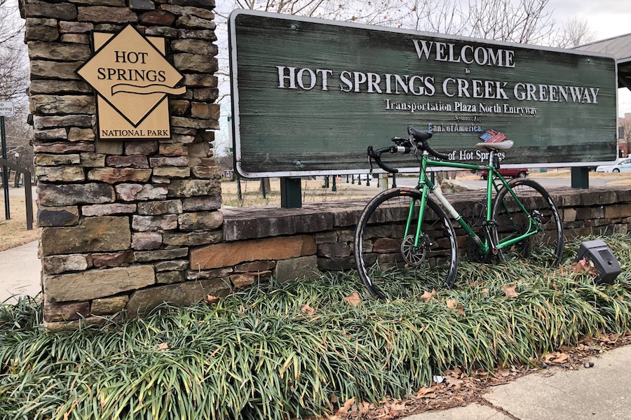
With public health problems among the worst in the nation and several small towns along the proposed route struggling to attract visitors, the trail could be the answer to many challenges Arkansas faces.
Stakeholders are in the final stages of raising $3.5 million for the trail design, which is expected to begin in the first half of 2018 and could take up to two years to complete. Construction of the first trail sections could begin before the ink is dry on the trail plan, with the bulk of the 50- to 65-mile greenway completed within five years. Early estimates peg construction costs at $17 million to $33 million, although officials hope most of that will be covered by federal grants and donations from such philanthropic organizations as the Walton Family Foundation.
Building on Success
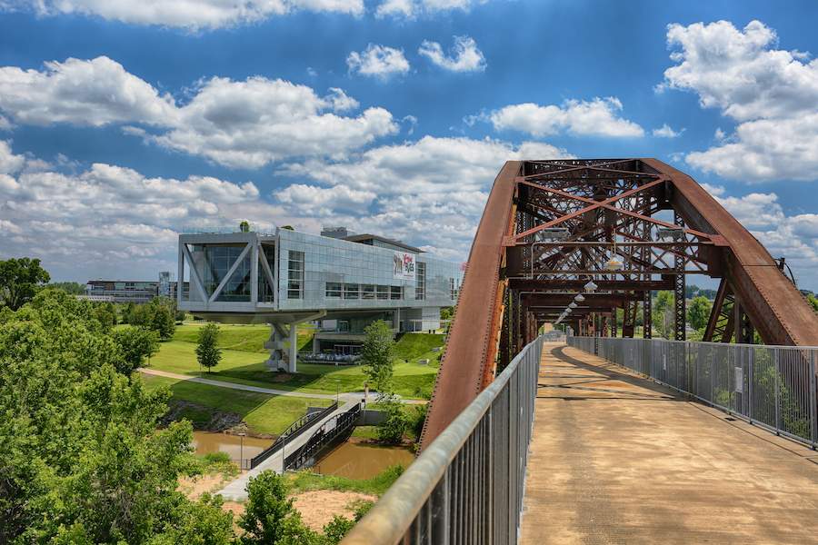
The success of Little Rock’s existing 15-miles-plus Arkansas River Trail and Big Dam Bridge is a major driver of the planned Southwest Trail, said former Pulaski County Judge Buddy Villines.
From April 2012 to December 2013, nearly a million people walked or biked the Arkansas River Trail and the bridge between Little Rock and North Little Rock, at 4,226 feet the longest purpose-built pedestrian/bicycle bridge in the world. Even on a chilly February Wednesday, bundled-up bikers and walkers are out in full force on the bridge.
“Since building the [Arkansas River] trail started [about 15 years ago], the number of walking and cycling groups around Little Rock has exploded,” said Dr. John Landosky, City of Little Rock bicycle and pedestrian coordinator.
The trail has spurred excitement among Little Rock’s active community, but that’s not all it has stimulated. Just off the trail, the high-end Brightwaters Apartments have sprung up, capitalizing on the desire of young urban professionals to be close to the city’s popular amenity. The Meteor Bicycle Cafe reopened with its new name last year, under the management of Intelligentsia Coffee founder Doug Zell. The name reflects the burgeoning bike culture spurred by the trail. Allied Cycle Works opened in Little Rock in the last two years, becoming the only mass producer of carbon bicycles in the United States. And once complete, the Southwest Trail is likely to boost neighboring property values substantially.
Villines, who spearheaded creation of the Big Dam Bridge, which opened in 2006, sees great potential for the Southwest Trail. “A 2-mile trail is a great amenity for a neighborhood,” he said. “A 20-mile trail is a great benefit for a city. But a 50- or 60-mile trail? That’s a national attraction.”

Trail Connections
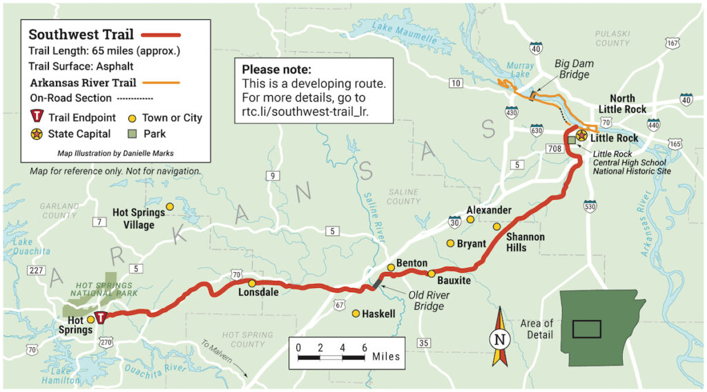
The first priority will be connecting the Southwest Trail with the Arkansas River Trail to create a quality connection that encourages cross use. Mile 0 of the Southwest Trail will link the two rail-trails at an active Union Pacific track a few miles from Little Rock Central High School. Immediately south of the connection, as the trail and active tracks go under a bridge, the current plan calls for a 32-foot buffer and a grade separation between the trail and the tracks. The grade separation will be created by a combination of piers and a retaining wall whenever the trail is closer than 50 feet to the tracks, meeting or exceeding Union Pacific’s 2008 proposed structural elements to address safety concerns, said Landosky.
Plans also call for tying up the few remaining connection problems on the Arkansas River Trail, particularly near the world headquarters of Dillard’s department stores, where a land dispute spits riders off the trail onto a narrow sidewalk and through heavy-traffic roads.
Win-Win
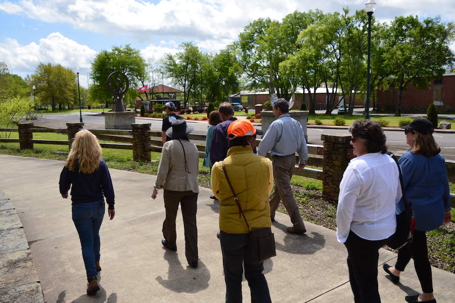
The coalition of city, county and state officials; business leaders; and community members that has come together to develop the Southwest Trail may be the biggest assembled for such a task in Arkansas.
“We all believe that working together, finding regional solutions to improving economic development and the health of our community, is in everyone’s best interest,” said Pulaski County Judge Barry Hyde.
Even Arkansas Governor Asa Hutchinson is involved, albeit in more of a cheerleading capacity at the moment. “The Southwest Trail will open up some of Arkansas’ most scenic spots to bicyclists and hikers,” said Hutchinson, who has been a huge trail proponent throughout his three years in office. “I imagine that the trail will encourage more Arkansans to get out on their bicycles as well as attract cyclists from all over the country. Much passion and thoughtful planning have gone into this project. I’m looking forward to riding on it myself once the project has been completed.”
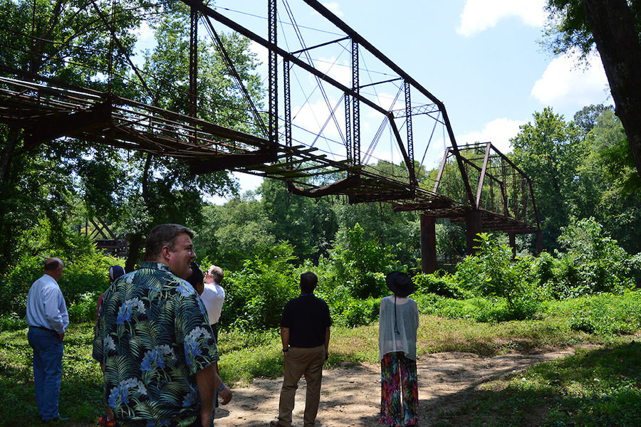
Towns are hoping they can entice visitors—and their wallets—with the draw of local history. Near the town of Benton, for example, cinephiles might recognize the steel-truss Old River Bridge from the Billy Bob Thornton movie “Sling Blade.” The second-oldest bridge in Arkansas, it actually was part of the original Southwest Trail route when it was built in 1891. It’s been closed to traffic since 1974, when a concrete truck damaged the bridge’s wooden platform. (The local legend changes based on who’s telling the story, so it’s not widely known if the truck went plummeting down into the Saline River or managed to make it to the other side unscathed.) Saline County is using federal grant money to refurbish the bridge.
Trail Impact
A preliminary action plan created by Alta Planning + Design conservatively estimates an influx of 65,000 new visitors annually from around the country, pumping about $3 million into the economies of all the local communities along the trail. The total economic impact of the new rail-trail is expected to be nearly $5 million annually, with nearly 70 new jobs created. Spur trails will likely attract trail users to nearby entertainment districts such as Benton’s $49-million River Center. National Park Service personnel believe the amount of visitors to Little Rock Central High School will rise at least 10 percent.
Trails Transform America
Southwest Trail: Connecting People, Communities and Economies for a Stronger Region
Learn more about the benefits trails are creating in Arkansas and across the country at our Trails Transform America campaign website. Our latest featured project is the Southwest Trail, stretching from Little Rock to Hot Springs—and you can read more about this developing trail network.
People along the proposed trail route hope to fatten their bottom line, but public-health advocates believe the trail will do the opposite for their collective waistline. With more than a third of the state’s residents considered obese, Arkansas is one of the most overweight states in the country, according to data from the United Health Foundation. It’s also the most inactive state; more than 30 percent of residents get little to no exercise outside their job.
The good news is that more than 9,000 people live within a quarter-mile of the proposed trail route, and many of them are expected to be active users. If 6,000 people began using the trail regularly for exercise, Alta estimates $18 million in health-care costs could be saved.
Hot Springs Past, Present and Future
On the other end of the proposed Southwest Trail, Hot Springs stands ready to greet new visitors.
The original Southwest Trail was part of an informal network of roads used for migration through the South. Settlers started in Missouri and Illinois, passed through Arkansas and ultimately reached Texas. In time, a railroad paralleling the trail was constructed. But instead of settlers looking for a new life, the Rock Island Railroad carried first-class passengers looking to visit the local wellness centers to soak in the naturally heated hot springs, then partake in some illicit gambling and drinking.
This was back when Hot Springs was a playground for organized crime mobsters, explains Michael Hibblen, author of “The Rock Island Railroad in Arkansas.” At one time, mining was a key industry in the area near Hot Springs. The former Rock Island Railroad tracks from Malvern to Hot Springs are still in use because the region has a lot of heavy industry, Hibblen says. The Missouri Pacific had a much more direct route to Hot Springs from Little Rock, but was abandoned decades ago because it lacked direct access to the lucrative mining centers.
But the tourism industry, not mining, has always been the biggest draw for Hot Springs. “The springs that come out of the ground there—hence the name—were also touted to have had medicinal qualities,” Hibblen said. “Bathhouses and resorts also brought in a lot of tourists,” as well as gangsters and major-league baseball teams. The concept of spring training was invented in Hot Springs, as the Chicago White Stockings—you know them now as the Chicago Cubs—came to town in 1886 to train in a warmer climate. In the decades to follow, more teams would find their way to the area, drawn by the hot springs, the tourist crowds and miles of trails that were perfect for early-season conditioning.
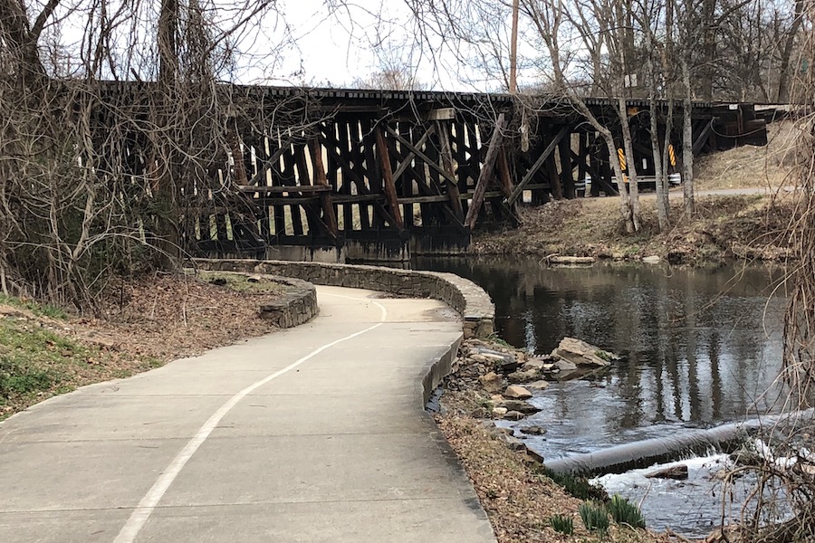
Today the town is a National Park that draws 1.5 million visitors a year. The bubbling spring water is still a major draw; on any given day, you’ll see crowds of tourists filling 5-gallon jugs at the fountains spread around town. But biking is also becoming a major part of the area’s appeal. A greenway stretches 2.5 miles from the Transportation Depot, hugging a picturesque creek. Mountain bike riders have three IMBA Epic Trails and more than 200 miles of single-track.
Local business leaders are thrilled that even more riders could be pedaling their way on the new rail-trail. “The Southwest Trail is great news for Hot Springs,” said Alan Sims, general manager of the Arlington Resort Hotel & Spa. “Our hotel is perfectly positioned to be a natural choice for bikers and every outdoor enthusiast, and we’re already planning creative ways to accommodate bikers and their equipment as they arrive off the new trails. Imagine the exhilaration of riding almost 45 miles of beautiful, natural trails, securing your equipment, relaxing in the natural thermal waters of our bathhouse, then enjoying a host of dining and entertainment options right outside your door.”
Related: David Paul Cook: An Artist’s Trail Journey
Route Alternatives
Initial plans call for the Southwest Trail to follow the defunct Rock Island Railroad corridor. In most places, the abandoned line is overgrown with weeds, bristling with scrub trees and littered with empty cups left by squatters or urban adventurers. The trail would help clean up the area. But part of that railroad right-of-way has reverted back to the landowners—more than 60 parcels owned by at least 30 individuals or companies—and that potentially drives up the acquisition price. Pulaski County may own or have full access to the right-of-way running through it, but the other two counties along the route, Garland and Saline, are not so lucky.
No right-of-away discussions will start, Saline County Judge Jeff Arey says, until the final route has been decided. But if the former Rock Island right-of-way becomes too difficult to obtain for Garland and Saline counties, trail planners have offered alternatives, including building the trail along the Highway 70 right-of-way.
The high-speed highway wouldn’t be the most scenic option—strip malls and used-car lots aren’t nearly as picturesque as trees and mountains, after all—but Garland County Judge Rick Davis said there is plenty of room to safely build a trail away from traffic.
Davis prefers transforming the much less trafficked and much more scenic Spring Street into a trail from Hot Springs to Lonsdale, about a quarter of the total trail distance. “It gets all kinds of drainage issues, so it’d take some work to fix, but it’d be worth it.” Davis said. “The road is lined with trees and offers plenty of shade in the summer. Riders would get these gorgeous views of the Ouachita Mountains; it’s almost a mystical feel.”
Because the railroad right-of-way is a substantial 100 feet, Hot Springs Intracity Transit Director Kathleen A. Lambert hopes to piggyback on the trail construction by building a separate bus or high-speed rail line parallel to the Southwest Trail. Other local officials don’t share her enthusiasm for the idea, but plan to keep an open mind.
Trails Transform Communities
The Southwest Trail could transform many of the sleepy towns along its path. Bryant Mayor Jill Dabbs believes the trail can spur development around an actual town center, something the community of 20,000 residents has never had. Bryant officials recently created a master lighting plan that includes the Southwest Trail, years before the first shovel will hit dirt.
“We can’t get these trails done fast enough,” said Dabbs, who doubles as president of Metroplan, the local metropolitan planning organization. “We all want to ride them.”
It says something about the excited anticipation of the trail that a Friends of the Southwest Trail group is up and running before the first foot of blacktop has been laid. Group President Daniel Lysk said the organization is just “waiting for our marching orders.” In the meantime, it has been helping other Arkansas trail organizations with trail cleanup efforts.
Officials hope that the race to build the trail will become a competition of sorts. “Of course, some areas will have their segments of the trail built first,” said Arey. “As those initial miles of trail are being built, we want residents to put pressure on their [municipalities] and demand their sections get built even faster. People are already anxious for this to get built. This is going to be a trail that everyone will be truly proud of and love.”
This article was originally published in the Spring/Summer 2018 issue of Rails to Trails magazine. It has been posted here in an edited format.
Related Links
City of Little Rock
Southwest Trail Facebook Page
Friends of the Southwest Trail Facebook Page
Hot Springs National Park
Trail Facts
Name: Southwest Trail
Used railroad corridor: Rock Island Railroad
Trail website: City of Little Rock
Length: 65 miles (when complete)
Counties: Garland, Pulaski and Saline
Start point/end point: Arkansas River Trail (Little Rock) to Hot Springs
Surface type: Asphalt
Grade: The pathway is anticipated to have the relatively level grade typical of most rail-trails.
Uses: Walking, bicycling and inline skating; wheelchair accessible
Difficulty: With a paved surface and easy accessibility to the communities connected by the route, the pathway is anticipated to be a safe and comfortable walk or ride for users exploring sections of the 65-mile route.
Getting there: For visitors flying into the region, the Clinton National Airport (1 Airport Road, Little Rock) is just a few miles southeast of the Arkansans River Trail.
Access and parking: The north end of the Southwest Trail will begin at a juncture with the Arkansas River Trail on the south side of the Arkansas River; parking is available in Little Rock’s Riverfront Park (400 President Clinton Ave.). From there, the future trail will wind southwest to Hot Springs with parking available in the many communities along the 65-mile route.
To navigate the area with an interactive GIS map, and to see more photos, user reviews and ratings, plus loads of other trip-planning information, visit TrailLink.com, RTC’s free trail-finder website.
Rentals: On the north end of the Southwest Trail, Rock Town River Outfitters, located at the Little Rock River Market, offers hybrids, mountain bikes, road bikes and tandems for adults, plus kid’s bikes and child tag-a-longs. On the south end of the Southwest Trail, bike rentals are available from Parkside Cycle (719 Whittington Ave.) in Hot Springs.

Donate
Everyone deserves access to safe ways to walk, bike, and be active outdoors.
