Nebraska’s Cowboy Recreation and Nature Trail
Trail of the Month: September 2017
“The Cowboy Trail complete…would be a wonderful asset for our state.”
Adventurers, take out your bucket lists and write this one down. Nebraska’s Cowboy Recreation and Nature Trail offers an authentic Old West experience, small towns with genuine, friendly people and picturesque landscapes of the High Plains and pristine prairie. At a whopping 219 miles, it’s already the third longest rail-trail in the country and yet has 100 more miles awaiting future development.
“This is farm country,” says Kris Ferguson, a resident of Gordon, one of several communities that dot the trail. “There are sunflower fields that you pass by that are so beautiful, and blowing grass. The trail holds its own beauty. The colors of the sky are amazing, too, because you can see so far.”
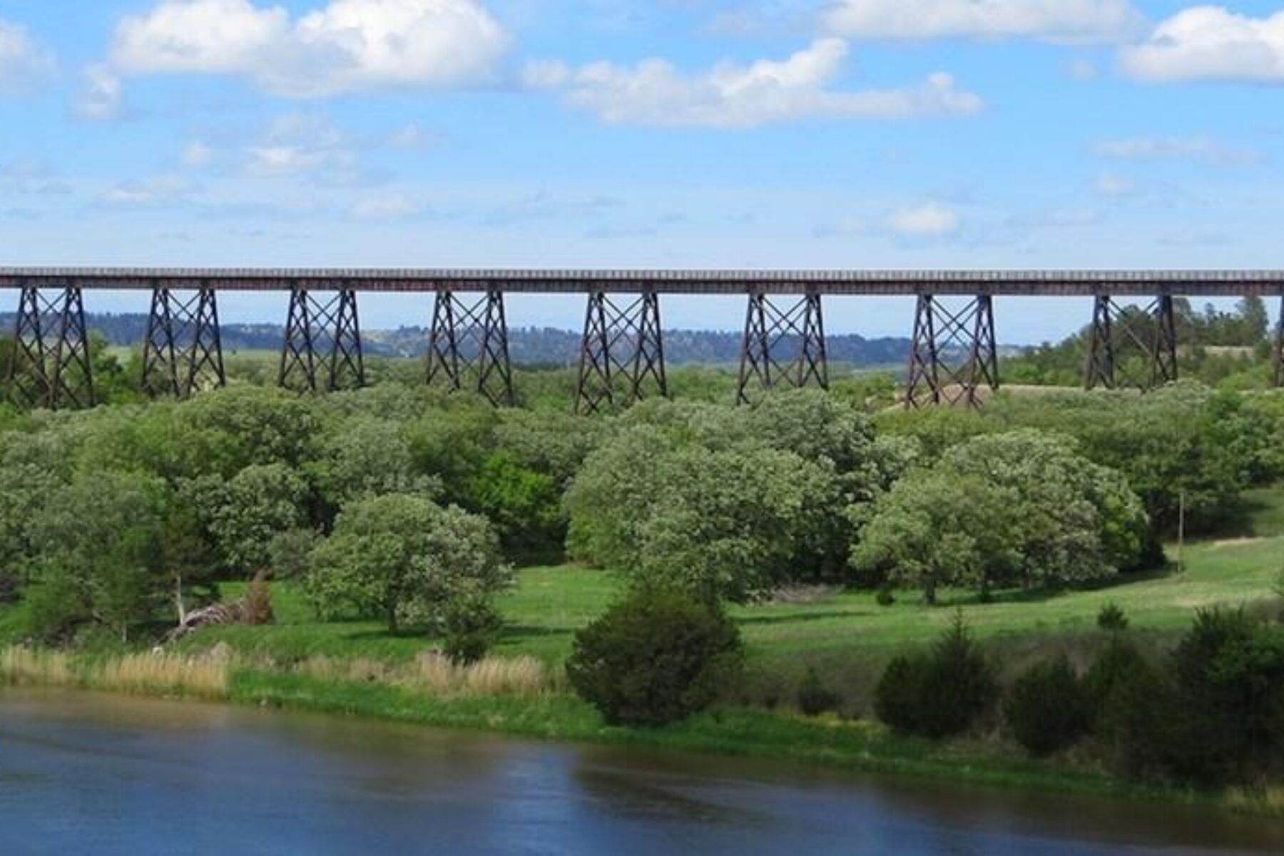
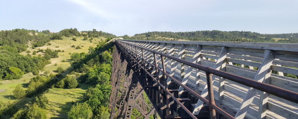
Although overshadowed by two other iconic rail-trails in the Midwest—Missouri’s Katy Trail to the south, and South Dakota’s Mickelson Trail to the north—this is one not to miss. And finally, it seems, the world has taken notice. This past June, aerial footage of the Cowboy Trail’s bridge over the Niobrara River went viral, amassing more than 2 million views (more than the population of the entire state). With its sweeping, bird’s eye views of the impressive structure spanning a quarter mile and rising 148 feet above the water, the video has given the trail our full attention.
Even for less intrepid travelers, that unforgettable bridge, built by the Chicago and North Western Railroad (C&NW) in 1910, is easily accessible. Starting in Valentine, you can pedal or walk two miles southeast down the rail-trail to reach it. And just east of town, the Fort Niobrara National Wildlife Refuge offers pioneer-like surroundings with roaming buffalo, elk and prairie dogs.
The trail itself is a haven for wildlife. Eagle-eyed travelers might spot white-tailed deer, wild turkeys, muskrats, beavers and many types of birds—even a plethora of monarch butterflies which migrate through the area in the fall. Milkweeds have been planted along the trail by volunteers as habitat for the pretty pollinators.
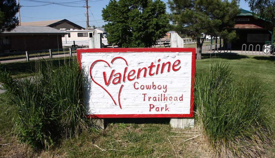
Between Valentine and the opposite end of the trail at Norfolk lies a continuous stretch of crushed-stone pathway spanning just over 200 miles. When the C&NW abandoned the line in 1992, Rails-to-Trails Conservancy (RTC) purchased the corridor and donated it to the state of Nebraska for trail development. Chuck Montagne, a founding board member of RTC who was instrumental in railbanking the corridor, once called the area “Dances With Wolves country.” His mother grew up in O’Neill, one of the towns that flourished along the railroad, built in the 1870s to fuel the Black Hills Gold Rush.
Today, the eastern Norfolk end of the pathway traverses the lush Elkhorn River Valley and has the highest use as the towns here are larger and closer together, and situated only a two-hour drive from Omaha and Lincoln, the largest cities in the state.
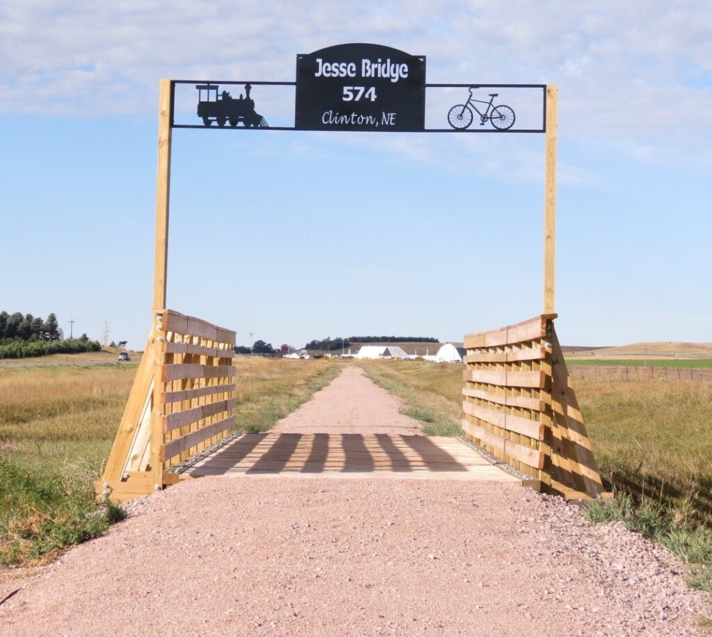
More than a dozen additional miles of trail, disconnected from the main spine, are also open west of Valentine between Gordon and Rushville. This western section is primarily a dirt trail currently, but a few miles of it offer a crushed-stone surface and, by the end of 2018, all of it will have the upgraded stone surface. Between the two completed segments, a large gap of undeveloped corridor awaits, and another 30 miles of trail to extend the route farther west to Chadron would complete the original vision.
“The trail is a real good thing,” says Ross Elwood, a long-time resident of this windswept northwestern corner of the state who has owned a repair shop and parts store for farm equipment here for the past 50 years. “When the 321 miles are done, it will be a great thing for Nebraska.”
Nebraska Nice

It’s a rustic ride to be sure, so carry provisions with you, but don’t let the fact that there are no dedicated trail amenities scare you off. Towns—spaced roughly every 10 to 15 miles along the trail—offer public parks and businesses that are friendly to travelers, where you’ll have access to restrooms and water to fill up your bottles. As locals will tell you, the motels here are “nothing fancy,” but you will find some unique gems like the historical Bassett Lodge and Range Café, which has charming décor that offers a time-machine-like glimpse into the 1950s.
“One of my favorite spots is this place called the Newport Pool Hall,” says Alex Duryea, who has ridden the trail from Valentine to Norfolk and works for the Nebraska Tourism Commission. “It’s on the honor system; there are no employees. If you want a candy bar or a t-shirt, you just leave the money.”
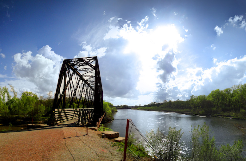
The quirky hole-in-the-wall joint is located just off the trail in Newport, a railroad hub in the 1880s and now home to just shy of 100 people. Before reaching the town, visitors coming from Valentine will also pass through the community of Long Pine and cross another bridge—in fact, there are more than 200 of them along the entire route. A crystal-clear creek of the same name just west of town is a local favorite for trout fishing and tubing. The stream traverses a forested canyon up through the Long Pine State Recreation Area, a pleasant place to camp for those making the trail journey over the course of a few days.
Elwood tells the story of a husband and wife from Dallas that he once met on the trail who were aiming to hike the whole route. When he asked them what they liked best about the trail, they told him it was people they met along the way. Once, when they asked someone where the nearest laundromat was, the person said, ‘Give me your clothes and I’ll wash them.’ Another time, when they were low on food, a resident gave them the keys to his pick-up truck so that they could make a run to the grocery store.
It Takes a Village (of Volunteers)
The love and commitment that locals have for the trail is evidenced by the development of that separated section known locally as Cowboy Trail West. In this sparsely populated, rural area, where government budgets are extremely tight, a core of volunteers stepped up with might and muscle to make the trail between Gordon and Rushville happen.
Related: Five Great Ways to Give Back to the Outdoors
When the railroad ties were pulled up in this western leg by a salvaging company, they unfortunately tossed the scrap to the side instead of disposing of it properly. The trail project then stalled out and the corridor languished for years.
“I went for a bike ride,” says Ferguson as she begins the tale of how she became involved in the project back in 2011. “At the time, the trail was just a weed-filled patch full of debris, so I was riding on the shoulder of the highway. A car went off the road and struck me. I had several broken bones and, while recovering, I started thinking about the trail because I wasn’t excited about riding my bike on the highway again. I still had one good arm and my mouth worked, so I made a phone call.”
Ferguson started a petition in her community to see if there were others who wanted to help out with the effort. She received a lot of positive feedback and went on to become a founding member of a nonprofit group called Cowboy Trail West, Inc., that provides volunteer labor to maintain this stretch of trail.
“It was such a mess,” says Elwood of the trail back then; around the same time as Ferguson’s accident, he was also thinking about what to do about the corridor. “There were pieces of railroad tie lying everywhere. It looked terrible, so I said, ‘Let’s get together and clean that.’”
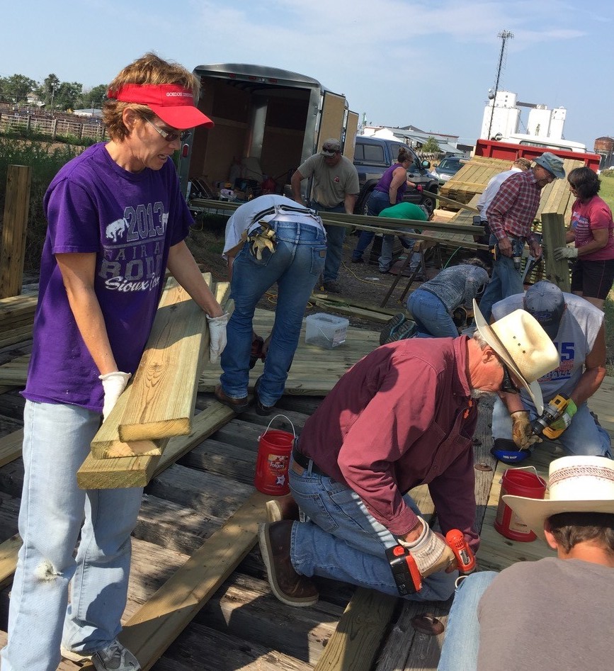
As he gathered up like-minded souls for the clean-up effort, Elwood heard about Ferguson and her group of trail advocates, and the two of them have been working together on the trail ever since. The volunteers they rallied hauled away 60 truckloads of ties and trash from the corridor, a monumental and essential turning point for the trail’s development.
“There are quite a few people that are using the trail now and a few people that think we’re crazy,” chuckles Elwood, who now serves as president of Cowboy Trail West, Inc. To those skeptics who say the trail is a waste of time and money, he has a ready answer. “I tell them: We’ve done this with volunteers and grants that would’ve gone somewhere else. The money is coming to Sheridan County and we don’t get a lot of things in Nebraska.”
More recently, Elwood and the volunteer crew re-decked the last two out of five trail bridges that lay between Gordon and Rushville. To support these efforts, Cowboy Trail West, Inc., received a $5,000 Doppelt Family Trail Development Fund Grant from Rails-to-Trails Conservancy this summer.
“It takes a tremendous amount of money, but we’re not giving up,” says Elwood of the continuing work on the trail, which includes weeding, spraying and mowing to keep weeds from encroaching. “We’re getting this done.”
Currently, the Nebraska Game and Parks Commission (NGPC), which owns and operates the Cowboy Trail, spends $150,000 annually for the labor and the materials to maintain the 200 miles between Valentine and Norfolk. Having a volunteer support system for the western portion of the trail was invaluable to the agency.
“We signed a maintenance agreement with Cowboy Trail West,” says Kirk Nelson, who manages the trail as the assistant division administrator for Planning and Programming at NGPC. “That was a real selling point. It brought us to the table in a hurry.”
The Cowboy’s Long Haul
Completing the trail will be a challenge—no doubt about it—but NGPC hopes their partnership with Cowboy Trail West, Inc., serves as a catalyst for more volunteer efforts in the other communities along the route. The agency also received a Doppelt Grant in 2015, using the money to spur trail-based community engagement, stewardship and education.
“I’m hopeful for the project because, if we’re going to deal with the healthcare issue in this country, trails are going to play a prominent role in that,” says Nelson. “We have to get people outdoors, walking and biking.”
Ferguson, who exemplifies America’s can-do spirit, says, “We would love to see the whole Cowboy Trail complete. I think it would be a wonderful asset for our state.”
Related Links
Nebraska Game and Parks Commission
Cowboy Trail West, Inc.
Visit Nebraska
Bike the Cowboy Trail
Trail Facts
Name: Cowboy Recreation and Nature Trail
Used railroad corridor: Chicago & Northwestern Railroad
Trail website: Nebraska Game and Parks Commission
Length: 219.3 miles
County: Antelope, Brown, Cherry, Holt, Madison, Rock and Sheridan
Start point/end point: The trail is currently open in two disconnected sections. A massive stretch of 204.9 miles is available between Ta-Ha-Zouka Park in Norfolk and S. Thatcher Street in Valentine, just north of Bridges to Buttes Byway/US 20. Farther west, after a gap of about 90 miles, a section of trail spanning 14.4 miles is open between S. Cornell Street in Gordon and N. Main Street in Rushville.
Surface type: The vast majority of the trail is crushed limestone, though a few of the towns have short paved segments through their communities.
Grade: The Cowboy Trail has the flat, easy grade typical of most rail-trails.
Uses: Mountain or hybrid bikes will provide the best experience on the trail. Walking around the town centers is also a popular use of the trail. Horseback riding is permitted as well on a paralleling natural-surface equestrian path.
Difficulty: Easy to moderate. Walks or rides close to the town centers are suitable for most ages and abilities, but longer rides will require more planning and preparation. Although dedicated trail restrooms and drinking fountains are not available on the trail, these amenities are readily available from the town parks and trailside businesses; communities along the trail are generally spaced about 10-15 miles apart. It’s also recommended to bring spare tire tubes as Texas sandbur seeds (puncturevine) can sometimes be found on some sections of the trail.
Getting there: The closest major airports are Omaha’s Eppley Airfield (4501 Abbott Dr.) and Lincoln Airport (2400 W. Adams St.), both about 120 miles from the eastern end of the trail.
The Sioux Gateway Airport (2403 Aviation Blvd., Sioux City), just over the border in Iowa, also offers some commercial flights; it’s about 80 miles from Norfolk.
Access and parking: Parking is readily available at the towns along the route. To navigate the area with an interactive GIS map, and to see more photos, user reviews and ratings, plus loads of other trip-planning information, visit TrailLink.com, RTC’s free trail-finder website.
Rentals: Your best options for renting bikes will be in Omaha and Lincoln, both cities about 120 miles from the east end of the trail. The Bike Rack offers mountain bike and hybrid rentals in both locations; please see their website for details and pricing. In Omaha, hybrids can also be rented from Greenstreet Cycles (2452 Harney St.).

Donate
Everyone deserves access to safe ways to walk, bike, and be active outdoors.
